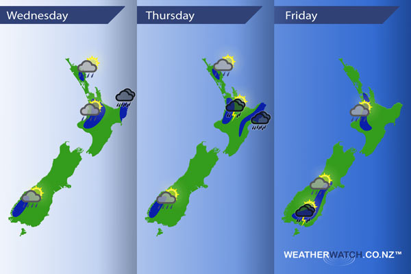
InfoGraphic: The main Weather Highlights across NZ for next 3 days
27/09/2016 6:00pm

> From the WeatherWatch archives
An east to northeasterly airflow lies over most of the country from today through till Friday.
Wednesday
Blue – Wednesday sees showers for much of the North Island during the day, a few of these may turn heavy late afternoon / evening then easing later in the day. A low risk of thunderstorms with these showers.
Isolated showers also possible about the ranges of Fiordland late afternoon.
East Cape and Gisborne sees rain during the day, possibly heavy especially in the ranges.
Thursday
Blue – About the ranges of Fiordland and about Northland isolated showers may develop with the chance of an isolated heavy fall afternoon / early evening. Southern Auckland and the Waikato through to northern Taranaki may see these showers turn into thunderstorms with a moderate risk present.
Gisborne and the ranges of Hawkes Bay may see areas of heavy rain, more so in the morning.
Friday
Blue – Isolated showers for parts of the North and South Island as depicted in the map below, mainly mid afternoon through to early evening. A chance these showers may be heavy with thunderstorms. A moderate risk of storms is present about inland Southland / inland Otago.

– Please note, the idea behind this update is to focus on the main weather highlights, which is why not all regions are mentioned.
For specific 10 day information for your city, town, rural community or island please see the 1000’s of forecasts on our homepage!
– Aaron Wilkinson, WeatherWatch.co.nz
Comments
Before you add a new comment, take note this story was published on 27 Sep 2016.


Add new comment