
> From the WeatherWatch archives
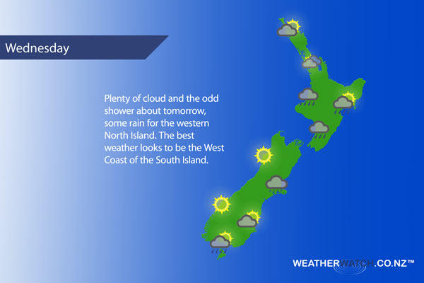
A front is fairly slow moving across the lower North Island on Wednesday, weakening in the evening. Not much happening for the South Island, a southerly airflow keeps conditions cloudy in the east and brighter out west.
For the upper North Island expect mostly cloudy weather, some sun possible for Northland and perhaps Auckland at times. The odd light shower possible for the Waikato and Bay Of Plenty.
Some rain for Taranaki down through to Kapiti then easing late afternoon / evening. The east coast sees some high cloud, a few showers spread northwards in the afternoon with a southwest change.
The South Island sees mainly cloudy skies in the east, the odd drizzle patch possible. Sunnier conditions out west.
Not all regions and towns have been mentioned above. For specific 10 day information for your city, town, rural community or island please see the 1500 forecasts on our homepage!
– Aaron Wilkinson, WeatherWatch.co.nz
Latest Video

NI low pressure, SI polar change
Low pressure will move over the upper North Island this week, bringing hit and miss pockets of heavier rain into…
Related Articles
NI low pressure, SI polar change
Low pressure will move over the upper North Island this week, bringing hit and miss pockets of heavier rain into…

Rain & showers this weekend, colder change next week
Some places will warm up over the next day or so as a nor’wester out of Australia moves across NZ,…

Temperature changes for some regions ahead of heavy West Coast rain
A nor-wester is about to kick in and it’s coming from out of Australia, boosting temperatures in some regions going…

