
> From the WeatherWatch archives
A high lies over the South Island on Tuesday while a light southeasterly airflow blows over the North Island.
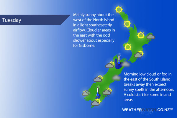
For much of the North Island in the west expect mainly sunny conditions with light southeasterly winds. Cloudier about Gisborne with a few showers or drizzle patches during the day. A mix of sun and cloud for Hawkes Bay and Wairarapa with the odd shower still possible.
Wellington sees any morning drizzle clear then cloud breaks to sunny spells, light southeasterly winds ease.
Mainly sunny for the upper South Island however there may be some morning low cloud or fog in the east, winds generally light. A cold start inland starting out between 1 to 3 degrees celcius.
Fairly cloudy to start about Southland and Otago especially near the coast with some drizzle or a shower possible then breaking to sunny spells in the afternoon, light winds tend northeast about coastal Otago. The West Coast sees a mix of sun and cloud, mostly cloudy skies for Fiordland.
Blue – Heavy form of precipitation.
Purple – Strong winds.
Yellow – Temperatures around the mid 20 degree mark or over.
Not all regions and towns have been mentioned above. For specific 10 day information for your city, town, rural community or island please see the 1500 forecasts on our homepage!
– Aaron Wilkinson, WeatherWatch.co.nz
Latest Video

Wintry weather coming: Snow, rain, wind & sunshine
A cold front is moving into NZ from Friday to Sunday with low pressure developing west of NZ and then…
Related Articles

Polar airflow + northern low = pockets of heavy rain & snow
A colder change is coming – and so too is a large low which will develop and grow over northern…
Wintry weather coming: Snow, rain, wind & sunshine
A cold front is moving into NZ from Friday to Sunday with low pressure developing west of NZ and then…

ClimateWatch: JULY outlook & what El Niño means for NZ
El Niño is officially here and still getting stronger in the months ahead, but it’s harder to notice its effects…

