> From the WeatherWatch archives
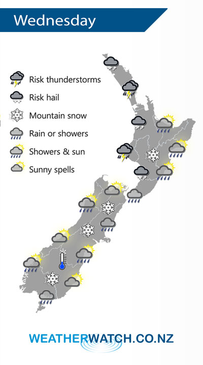
A cold front / pool of air moves off the upper South Island on Wednesday and onto the North Island, conditions settle a little further south but still quite cold.
Showers for the western North Island on Wednesday, becoming heavy in the afternoon with a risk of thunderstorms and hail then easing later on. Snow lowers to 500m about the Central Plateau. Rain or showers moves into Wairarapa in the morning then further north in the afternoon with a southwest change.
Morning rain about the upper South Island may be heavy then easing to showers in the afternoon, becoming restricted to coastal areas in the evening, snow to 400m. The West Coast is mainly sunny, morning rain about North Westland clears. Showers about the far south for much of the day, snow flurries to 400 or possibly even 300m at times.

By Weather Analyst Aaron Wilkinson – WeatherWatch.co.nz
Comments
Before you add a new comment, take note this story was published on 30 Jul 2019.


Add new comment