Incorrect MetService Tweet highlights need for open weather data….again
22/06/2017 10:05am

> From the WeatherWatch archives
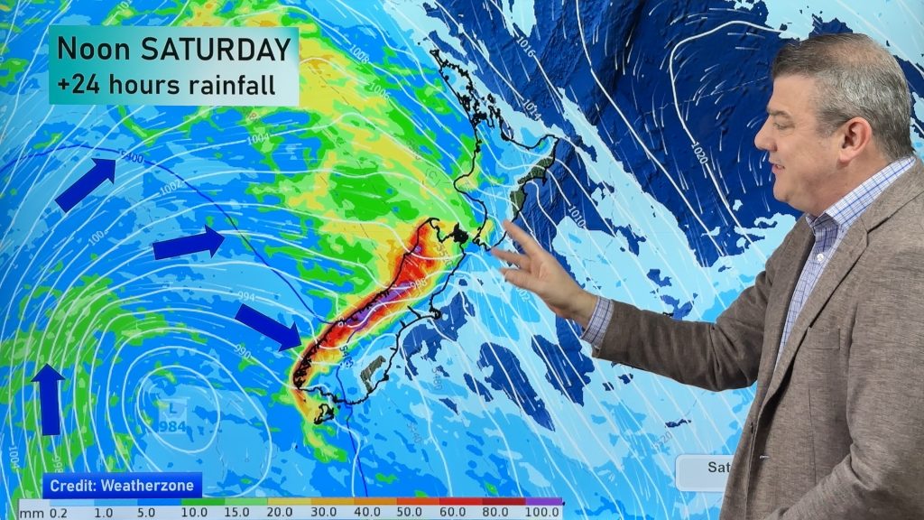
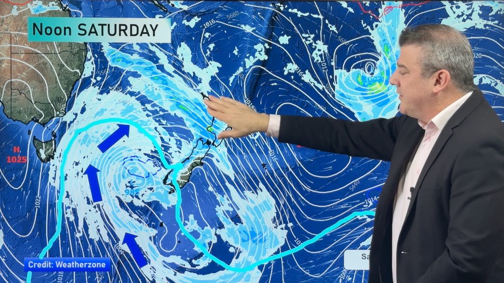
Published Thursday Evening — On Monday WeatherWatch.co.nz described the current incoming sub-tropical low as “frustrating to forecast” due to it’s large size, slow tracking and the fact the large centre means there will also be large areas of calm and dry. To make matters more frustrating the large mountains and ranges in New Zealand can block the rain, stop the rain or make it heavier and prolonged for a few – and just a tiny shift in wind flow can have significant consequences.
This evening heavy rain remains out at sea for the most part in the north east of Northland and east of Auckland. There is the risk of a heavy isolated downpour, otherwise dry for now.
As we reported late Thursday afternoon the low is gently nudging this rain away from Northland and Auckland for the most part while at the same time the nor’east flow is trying to pull it back to land. So this rain band is being pushed and pulled a bit and breaking apart.
We’ve had a lot of questions across Thursday PM about where the rain is and why it hasn’t turned up, a lot of this curiosity has been generated by the news media today or tweets like this one from state forecaster Georgina Griffiths at the New Zealand Government agency MetService on Thursday PM.
The New Zealand Government currently is the only western country on earth to prohibit us from showing you live radar funded by the taxpayers so we can only share their tweets, even if inaccurate:

So what is happening this evening?
Firstly – the entire evening was dry to mainly dry with the rain out at sea. A little drizzle and light fell, and a brief heavy downpour in some parts of Great Barrier Island.
Other forecasters also noticed most of the rain was offshore this evening, like meteorologist Dan Corbett from State broadcaster One News:
Still a heavy shower/thunder risk up north into evening but most to N+E & offshore. Notice outflow from earlier collapsing t-storm. pic.twitter.com/bWs5MTyNtW
— Daniel Corbett (@danielcorbetttv) June 22, 2017
So here’s WeatherWatch.co.nz’s view tonight:
The centre of the low is creeping closer to the upper North Island – but this is where there is mostly dry/calm weather.
As the centre of the low moves in it actually helps nudge the rain clouds along and out to sea ahead of the centre. Sort of like a stick floating in the water and you’re pushing a hand behind it slowly. However at the same time as the rain is being nudged gently eastwards the clockwise ‘whirlpool’ nature of the winds around the centre of this low are then pulling some of the rain clouds back around the centre – so this rain band to the east of Auckland is tracking both South-South-East and a little bit South-West towards the Hauraki Gulf/Auckland area.
At this stage this action appears to be significantly weakening and shredding up these rain bands for the Auckland and Northland areas – with almost all of the rain out at sea and mainly dry weather extending across these two populated regions.
Auckland has had a mostly drizzly and dry afternoon and evening so far – even late sunny weather moved into Northland.
As WeatherWatch.co.nz has being saying all week – this is a not currently a storm, there are large areas of dry and calm weather between the big downpours and gusty winds.
Recently Aucklanders were also warned through Government agencies that the Harbour Bridge may close later that afternoon due to Cyclone Cook – something WeatherWatch.co.nz dismissed before dawn that day.
However, sub-tropical systems are usually “ones to watch” – see below why you need to keep up to date.


– Infographics / WeatherWatch.co.nz as of 9:30pm Thursday. Radar thanks to the NZ Taxpayer. Note how much the rain band has weakened compared to the tweet just a few hours earlier from MetService saying it was heading for Auckland Thursday evening.
Don’t get complacent! This is sub-tropical after all…
At the risk of now contradicting ourselves, a sub-tropical low can be unstable and that means rain clouds can bubble up quickly and be quite intense – especially with low pressure moving in.
On Friday the low deepens further so we may see more quite isolated pockets of flooding as the rain bands track southwards down the eastern coastline of New Zealand (for the most part eastern areas are more vulnerable to heavier rain).
Once the low tracks over the North Island a wet and windy south west flow will blow over the upper North Island later on Friday/overnight and into Saturday.
Thank you for making WeatherWatch.co.nz New Zealand’s number one choice for a second opinion, especially during a week like this when there’s a lot of big headlines or warnings that don’t always match the weather at your place.
But remember to keep up to date with taxpayer funded weather warnings from Government agency MetService too, even if our forecasts do sometimes differ.
– WeatherWatch.co.nz
Comments
Before you add a new comment, take note this story was published on 22 Jun 2017.


Add new comment