Funnel between two systems – The Big Picture on Thursday
18/11/2015 4:43am

> From the WeatherWatch archives
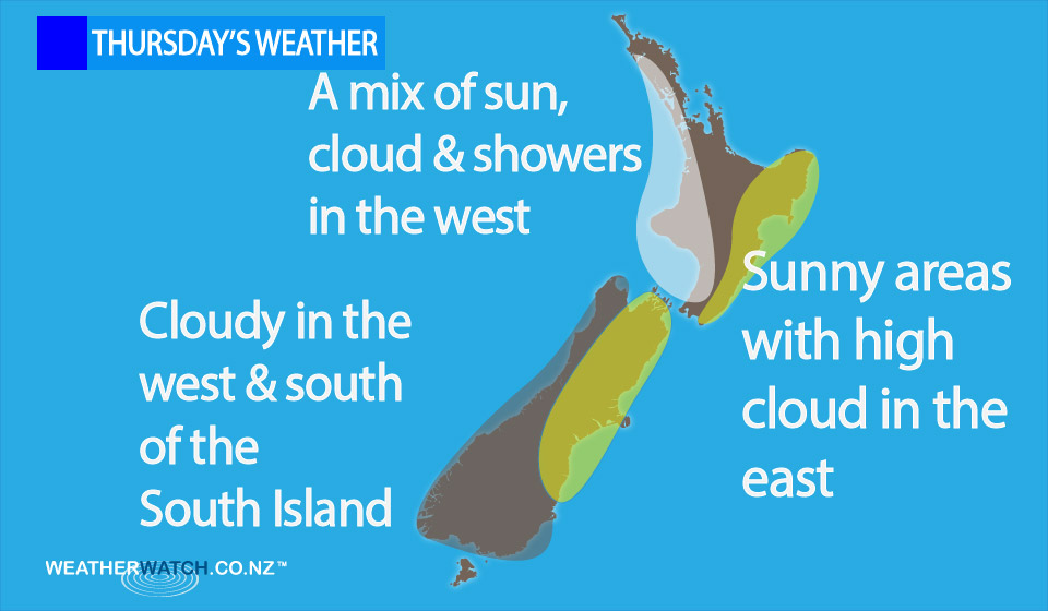
On Thursday we have a northeasterly airflow over New Zealand which is being funnelled between a high to the east of the country and a low in the Tasman Sea to the west.
Sunny areas and some high cloud stick around for eastern regions of both islands, keeping conditions mainly dry.
In the west some regions see areas of cloud and the odd shower.
The West Coast of the South Island will likely be mainly cloudy from morning, whereas western areas of the North Island sees some sun in the morning, then the odd shower late afternoon and evening.
Auckland looks mainly cloudy from morning however, with the odd shower by midday.
– Aaron Wilkinson & Drew Chappell, WeatherWatch.co.nz
Latest Video

Matariki, the long weekend + the outlook for next week
Wet weather and cloud continues along the eastern side of the country with the heaviest rain now moving into northern…
Related Articles
Matariki, the long weekend + the outlook for next week
Wet weather and cloud continues along the eastern side of the country with the heaviest rain now moving into northern…

More eastern rain, but a drier long weekend coming
Rain continues today along the eastern South Island and lower North Island, coming in from the east with heavy falls….

More heavy rain, snow – but large dry areas, especially as we go into the long weekend
Heavy rain will continue for parts of Canterbury and Marlborough over the next day or two and it will gradually…

