Front pushing north – The Big Picture on Thursday
21/10/2015 4:00am

> From the WeatherWatch archives
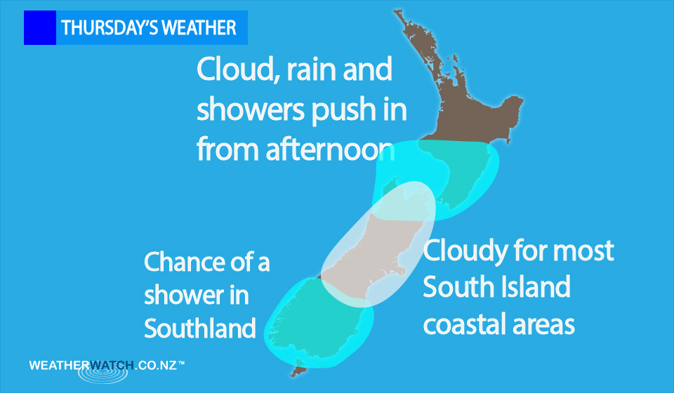
On Thursday we have a front clearing the upper South Island by around midday, moving onto the lower North Island in the afternoon and pushing a little further north – then weakening later in the evening.
Ahead of this front we have a brisk to strong northwesterly airflow, then winds change southerly in behind.
Most of the North Island will stay cloudy, with the odd shower patchy shower – then rain moves in to the lower North Island in the afternoon (further north later in the evening).
The South Island sees rain clearing by midday, though it will remain fairly cloudy in places, with southerlies tending east to northeast in the afternoon for most.
Cloudy areas stick around about coastal areas further south, leaving the chance of a shower or two during the day in Southland.
Meanwhile, it’s looking mostly sunny about South Westland, while heavy rain clears by around midday for North Westland.
It should remain fairly cloudy afterwards, though some sun may break through in the afternoon.
– Aaron Wilkinson & Drew Chappell, WeatherWatch.co.nz
Latest Video

Matariki, the long weekend + the outlook for next week
Wet weather and cloud continues along the eastern side of the country with the heaviest rain now moving into northern…
Related Articles
Matariki, the long weekend + the outlook for next week
Wet weather and cloud continues along the eastern side of the country with the heaviest rain now moving into northern…

More eastern rain, but a drier long weekend coming
Rain continues today along the eastern South Island and lower North Island, coming in from the east with heavy falls….

More heavy rain, snow – but large dry areas, especially as we go into the long weekend
Heavy rain will continue for parts of Canterbury and Marlborough over the next day or two and it will gradually…

