> From the WeatherWatch archives
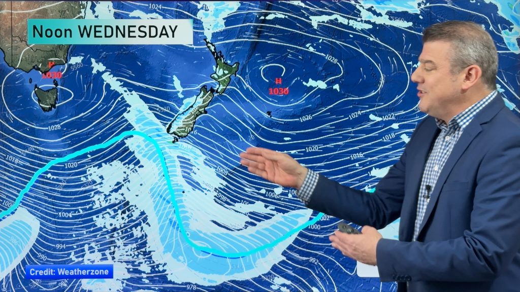
A front moves over New Zealand today pushing in from the west, crossing over to eastern New Zealand late afternoon or evening.
Northland, Auckland, Waikato & Bay Of Plenty
Dry at first then some afternoon rain, possibly heavy with thunderstorms then clearing evening although the odd remaining shower is possible mainly in the west. Northerlies change westerly late afternoon.
Highs: 15-17
Western North Island (including Central North Island)
Cloud increases in the morning, risk of a shower about Kapiti and Taranaki. During the afternoon rain starts to move in from the west then easing in the evening as northerlies change west to northwest.
Highs: 13-16
Eastern North Island
Sunny areas and some increasing high cloud, scattered rain spreads from the west in the evening then clearing at night. Northerlies tend northwest later in the day.
Highs: 16-18
Wellington
Mostly cloudy, some late afternoon / evening rain then clearing at night. Breezy northerlies.
High: 14
Marlborough & Nelson
High cloud, rain develops about Nelson in the morning then spreading into Marlborough at times from afternoon. Rain clears in the evening as northerly winds tend northwest.
Highs: 13-14
Canterbury
High cloud, may be a spot of rain late afternoon / early evening then high cloud breaks away. Northeasterly winds tend northwest later in the day.
Highs: 12-14
West Coast
Cloudy, dry at first then rain develops late morning, becoming heavy then easing to showers late afternoon as northeasterly winds change westerly.
Highs: 11-13
Southland & Otago
Plenty of high cloud, spots of rain mainly late afternoon then clearing in the evening as northeasterly winds tend northwest. Some sun possible later in the day before dusk.
Highs: 8-11
By Weather Analyst Aaron Wilkinson – WeatherWatch.co.nz
Comments
Before you add a new comment, take note this story was published on 11 Jul 2019.


Add new comment