> From the WeatherWatch archives
All forecasters are today warning farmers to be prepared for a heavy snow event despite computer models still not all agreeing that heavy snow to sea level is in the forecast.
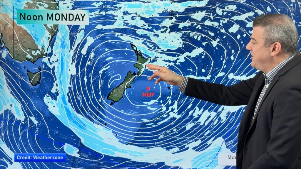
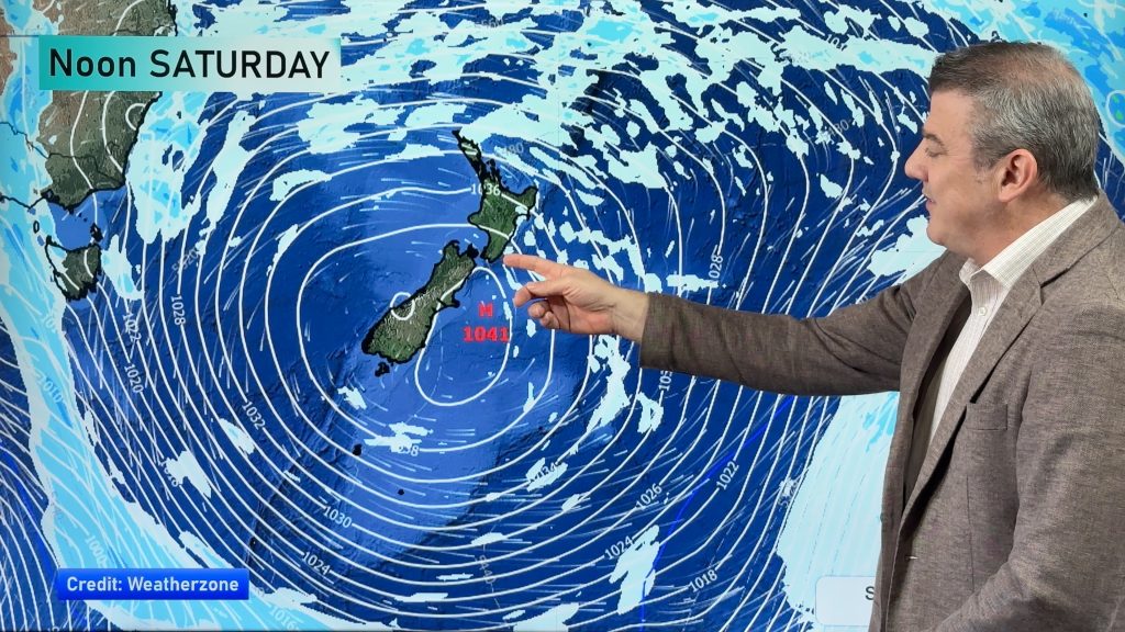
WeatherWatch.co.nz says latest data indicates the worst of the cold blast will still be just offshore to the east early next week as a massive high to the west combines with a deep low to the east – driving up a bitterly cold southerly from Antarctica.
WeatherWatch.co.nz also believes the heaviest snow may, in fact, fall in the North Island. This is because we expect the coldest of the air to be further east of places like Southland and Otago and the North Island lies much further east than the South Island. Moisture levels are also expected to be higher in the North Island.
However the close proximity of the offshore cold blast to New Zealand means people need to be aware that even a slight change in the weather systems could mean the difference between a non-event and a memorable snow storm.
The issue with the computer models (which all forecasters rely on to help make predictions) is that they aren’t sure where the snow will exactly fall – they do, however, all agree that a snow storm is likely.
WeatherWatch.co.nz said earlier today that the high in the Tasman Sea will stretch over 6000kms from the tropics to Antarctica on Monday which head weather analyst Philip Duncan said was “extremely rare”.
This high, combined with a deep low to the east of the country, will help fuel the wintry blast which is similar to the July snow storm – but has the potential to last longer. July’s snow storm lasted no more than 24 hours, whereas this system could last from Sunday until Wednesday.
However the models don’t agree on where the snow will fall. Half of the models WeatherWatch.co.nz uses pick it falling mostly out at sea between the South Island and the Chatham Islands.
“It is incredibly frustrating for us. The same data that picked snow in Christchurch, Nelson, Wellington and other places last month is this week telling us a snow storm isn’t expected, but there are certainly other models, along with MetService, saying we’re in for a snowy blast”.
Regardless of whether or not heavy snow falls to sea level, snow is still predicted to a couple of hundred metres in both islands with a bitterly cold southerly for everyone – but that could mean sunny skies for northern and western New Zealand.
MetService has been consistent with their message since yesterday – get ready for heavy snow on Sunday and Monday. The state owned forecaster has moderate confidence of heavy snow for about one third of New Zealand and lower confidence further north into eastern parts of the North Island.
We will closely monitor this possible snow storm and will bring you extra updates over the next few days.
FAQ
Will this be worse than the July snowstorm? It has the potential to be worse, but right now the data that we relied on to accurately pick that snow storm well in advance is not predicting the same conditions this time around.
Why has MetService made such a strong prediction but WW remains on the fence? WeatherWatch.co.nz has built up a reputation of being the first to predict most major national storms over the years, but this one is creating some strong debate between us as we look at all the models. We simply have too much doubt to say this will definitely happen and would rather be cautious.
Will it affect travel? Even if snow doesn’t fall in main centres we still anticipate heavy snow higher up. Gale force southerlies will also blast many regions so flights, roads, trains and ferry crossings could all be affected – highest risk for travel delays will be from late Sunday to late Tuesday. We cannot provide any further details on travel at this stage.
When will you be more certain? We hoped today that the models would all start to agree but that isn’t the case. Our biggest conflict is that our two most accurate models, which we have relied on for years, are coming up with two different scenarios. One of them will be correct, we’re just doing more research to figure out which one. We will be pretty confident by late Friday and early Saturday (hopefully sooner) – which still allows people 36 to 48 hours to prepare. We advise farmers to act now to protect livestock.
– WeatherWatch.co.nz
Comments
Before you add a new comment, take note this story was published on 11 Aug 2011.


Add new comment
sw on 11/08/2011 7:09am
ECMWF models show Rain or wind (or both) for Auckland each of the next 10 days and cloud from the weak ridge before the next low rolls from the north at the end of next week.
Reply
Guest on 11/08/2011 5:48am
ECMWF has been showing this polar outbreak for a couple of days now, GFS showed it a few days ago but backed off but the lastest run is now showing and extremely cold blast colder than late july.
Reply