Enormous low pressure system engulfs NZ, final cold change then it all clears
13/08/2019 3:45am

> From the WeatherWatch archives
As WeatherWatch.co.nz exclusively forecast a week ago a number of big lows have merged to create one enormous belt of low pressure which has covered the entire New Zealand area.
Now a storm in the Southern Ocean is helping send off this big low with one final act – an Antarctic southerly for some places.
Wednesday will have single digit highs in a number of southern regions and if you do make it to double digits there’s a good chance the feels like temperature (wind chill) will make it feel colder. The upper North Island is least affected by the colder change but some in the lower North Island will feel it, Wellington may only just reach 10 degrees.
WeatherWatch.co.nz says one positive for newborn livestock is that this final southerly change looks fairly dry, so snow may fall to low levels briefly but won’t amount to much. It’s dampness plus windchill that is the biggest killer for newborn livestock. Wednesday, while cold, will be fairly dry with showers and snow flurries clearing. Warmer air and higher pressure returns on Thursday.
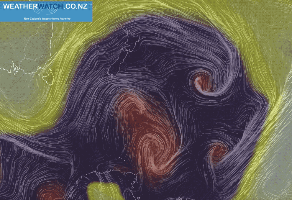
– WeatherWatch.co.nz
Latest Video

Cold weekend, frosts return with high pressure, then a low late next week
The subantarctic airflow spreads over NZ today/tonight and into Saturday, dropping temperatures nationwide. Snow flurries are possible today to lower…
Related Articles
Cold weekend, frosts return with high pressure, then a low late next week
The subantarctic airflow spreads over NZ today/tonight and into Saturday, dropping temperatures nationwide. Snow flurries are possible today to lower…

Wintry burst of weather: Snow, squally showers then sunshine & frosts
A polar change (another one!) arrives on Friday for the South Island and goes nationwide on Saturday, leaving NZ under…

Antarctic southerly for parts of NZ Fri & Sat
For the first time this year a southerly from off Antarctica is heading towards the South Island, followed by more…

