
> From the WeatherWatch archives
Wednesday will be colder than average in a number of southern places as a Southern Ocean southerly wipes away the warmer sub-tropical northerly.
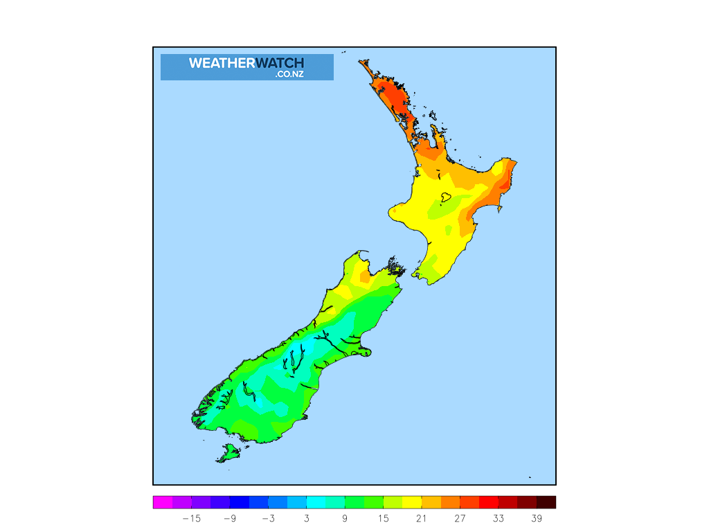
Daytime highs on Wednesday will be down with coastal Otago and Southland having highs between 12 and 15 degrees. Inland won’t be so bad, in fact Alexandra has a high of 21 today but is warmer tomorrow with 24 and sunnier skies. So it’s very much a coastal cool down around Southland and Otago.
But further north the cold will slide across the flat Canterbury plains on Wednesday, dropping daytime highs by nearly 10 degrees compared to today. Many places have a high in the low to mid teens (14 or 15).
The cooler change also moves into the Lower North Island but highs will still make the late teens.
Overnight lows are also taking a bit of a drop with some places down to just 3 to 7 degrees inland, with Northern Southland potentially the coolest place overnight tonight/Wednesday AM.
Warmer weather returns by Thursday with Wednesday the main cool day.
MAP: Maximum temperatures at 1pm on Wednesday…
See our new Maximum Temperature maps by clicking here.
WeatherWatch.co.nz
Comments
Before you add a new comment, take note this story was published on 2 Mar 2020.
Latest Video

NZ VIDEO: Severe weather going into the weekend. Next week: Westerlies continue
Heavy rain and northerly gales are moving across NZ going into the weekend as a large low from the Tasman…
Related Articles
NZ VIDEO: Severe weather going into the weekend. Next week: Westerlies continue
Heavy rain and northerly gales are moving across NZ going into the weekend as a large low from the Tasman…

VIDEO: Low pressure, cold fronts, main feature next two weeks
There are several low pressure zones and cold fronts coming into NZ, with westerly driven weather dominating our weather pattern…

VIDEO: Burst of wind and rain for NZ as low pressure dominates
Air pressure around New Zealand will continue to drop in the days ahead as low pressure systems affect our weather…


Add new comment