Clearing showers for most – The Big Picture on Friday
29/10/2015 4:42am

> From the WeatherWatch archives
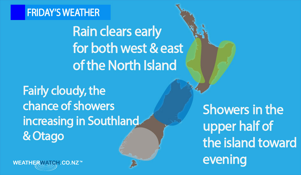
On Friday we have an easing southeasterly airflow over the North Island while a ridge spreads onto the South Island, before moving over the North Island later in the day and overnight.
Within the ridge of high pressure over the South Island, a weak, shallow low may form over the interior of the island, this may lead to some cloud building about inland ranges in the afternoon and evening.
This brings with it the chance of a light shower or two later in the day – though mainly this is for the upper half of the South Island.
Sunny areas and southerly winds build in the east of the island, before tending east to northeast in the afternoon.
Cloud then builds about inland ranges, with the chance of a light shower or two later in the afternoon and into evening mainly about the upper South Island.
For much of the West Coast expect mostly sunny weather with west to southwesterly winds.
Sunny areas for Otago, a little cloudier about Southland with the chance of a shower now and then, winds from the west or southwest.
For the North Island, any early showers clear in the west of the North Island – then expect sunny areas with south to southeasterly winds.
Late afternoon may see an isolated shower or two north of about the Waikato.
Along the East Coast, expect morning rain to mostly clear for all – then cloud breaks later in the day, and the odd shower may hang about Gisborne till evening.
– Aaron Wilkinson & Drew Chappell, WeatherWatch.co.nz
Latest Video

Matariki, the long weekend + the outlook for next week
Wet weather and cloud continues along the eastern side of the country with the heaviest rain now moving into northern…
Related Articles
Matariki, the long weekend + the outlook for next week
Wet weather and cloud continues along the eastern side of the country with the heaviest rain now moving into northern…

More eastern rain, but a drier long weekend coming
Rain continues today along the eastern South Island and lower North Island, coming in from the east with heavy falls….

More heavy rain, snow – but large dry areas, especially as we go into the long weekend
Heavy rain will continue for parts of Canterbury and Marlborough over the next day or two and it will gradually…

