A mix of cloud and showers – The Big Picture on Tuesday
27/06/2016 5:00am

> From the WeatherWatch archives
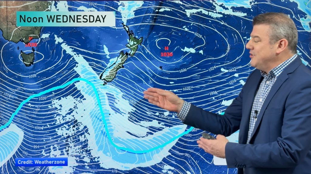
A southwesterly airflow eases over the country during the day, while a low in the Tasman Sea brews and moves closer towards New Zealand from the West.
In the Upper North Island, sunny areas dominate along with Westerly winds, whie there’s the chance of a shower or two in the west.
These should mostly clear during the morning, although a straggler or two may hang round till evening for some.
High cloud increases about Northland from morning, and then around Auckland from afternoon, while rain moves into Northland overnight, with heavy falls possible there by dawn on Wednesday.
Showers or patchy drizzle clears from Wellington and the Wairarapa in the afternoon, with some sun then breaking through.
A shower may reach Hawkes Bay in the late afternoon, otherwise it’s mainly sunny for the East Coast during the day, with westerlies.
For the South Island, a few morning showers clear most upper South Island regions, and then sunny areas increase as southwest winds ease.
For the lower South Island it’s mainly sunny from morning, while any early cloud clears away, and winds are mainly light.

– Aaron Wilkinson & Drew Chappell, WeatherWatch.co.nz
Comments
Before you add a new comment, take note this story was published on 27 Jun 2016.


Add new comment