
> From the WeatherWatch archives
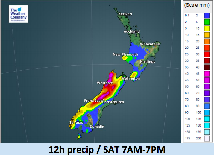
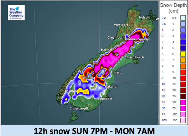
There is a significant blast of weather crossing the country over the next few days with gales move up the South Island and into the North Island over the weekend and heavy rain continuing off and on all weekend and into Monday on the western side of the nation.
These maps below help break down the expected rain and snow over the coming days.
The weekend, for the most part, is warmer than average but a colder change moves in to the South Island later on Sunday. Across Monday it extends further across the country turning rain to snow in the ranges/mountains and high country and dropping temperatures.


– WeatherWatch.co.nz
Comments
Before you add a new comment, take note this story was published on 6 Jul 2018.
Latest Video

(VIDEO) NZ 7 Day: Variety in the weather, but Southern Ocean storms waking up
Low pressure moves in to NZ from the Tasman Sea this weekend and completely falls apart – bringing downpours and…
Related Articles
(VIDEO) NZ 7 Day: Variety in the weather, but Southern Ocean storms waking up
Low pressure moves in to NZ from the Tasman Sea this weekend and completely falls apart – bringing downpours and…

VIDEO: ClimateWatch: July is the month of BIG lows, BIG highs
This month around New Zealand, Australia and the region we see big highs and big lows – bringing decent stretches…

VIDEO: Severe weather risks for NZ as low moves in
Programming Note: Apologies but we have no video on Thursday – back again on Friday! – A storm in the…


Add new comment