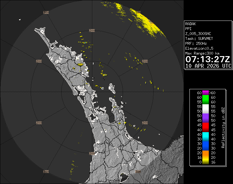
Weather Forecast for Auckland40m above sea level
Overcast with light South to Sou'East winds.
Now
Today
Tonight
Next 24 Hours in Auckland
Next 9 Days in Auckland
Day
Night
38km/h
chance
of rain
21.1mm
Day
Night
25km/h
chance
of rain
9.4mm
Day
Night
27km/h
chance
of rain
8.9mm
Day
Night
37km/h
chance
of rain
1.1mm
Day
Night
32km/h
chance
of rain
0.6mm
Day
Night
24km/h
chance
of rain
1.6mm
Day
Night
32km/h
chance
of rain
9.8mm
Day
Night
27km/h
chance
of rain
11.6mm
Day
Night
27km/h
chance
of rain
4.2mm
Comments
If you have any questions about functionality of our website(s) or app, trying to locate maps or data, or have a simple comment/feedback - please post a comment below!
As of 2024 we will no longer be publishing questions related to weather forecasts if they are answered via our hyper-local hourly & 10 day forecasts, weather maps and regular daily and monthly weather & climate videos.
We’re a small NZ business with limited resources to respond to general weather questions. Our social media pages may be helpful to you, especially if you want to often talk (or groan!) about your local weather. You can find more resources from us here if that’s your thing.
Have questions of a commercial nature? Contact us directly here.
Thanks for your support!
Don’t forget to check out our RuralWeather.co.nz website (great for event planning or attending + camping!) and also, our brand new Weather Alerting App!

Latest Video
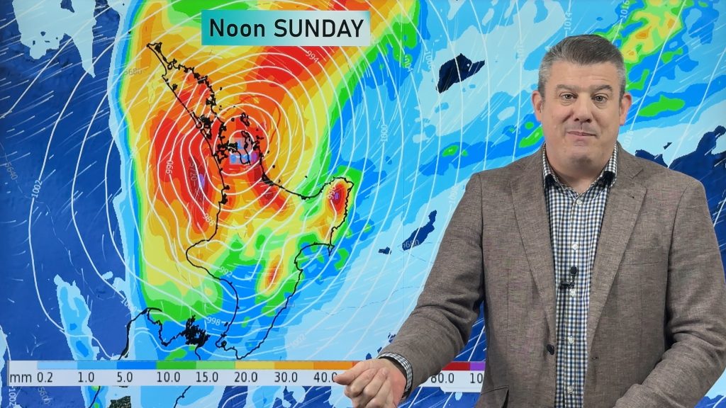
NZ (FRI): Latest cyclone tracking as Vaianu expected to zip over North Island
Cyclone Vaianu will cross the North Island rapidly on Sunday, making landfall somewhere around Auckland to Coromandel Peninsula during the…


Add new comment
Abigail on 10/04/2026 3:25am
Hi Phil and team WeatherWatch!
Always love and appreciate your work and your informative and calm forecasts.
Quick q about the rain totals for Auckland broken down hourly – the break down is done from 7am-6am but the overall total is done by the day – so Saturday 11 April has a very high rain total but when you break it down by hour the worst of it kicks off from about 1am onwards which technically informs the total for the day, for Sunday 12 April.
So at first glance Saturday’s total rain total for the day looks worse than Sunday’s….until you break it down by hour.
Also do you expect these totals to change tomorrow as they have been mostly consistent-ish for the last few days based on the modelling I assume?
Thanks,
Abigail
Just wondering if this is intentional?
Reply
Carla on 9/04/2026 10:45pm
Hi Phil, Can you explain why the windspeeds for the incoming cyclone differ considerably between your rural weather forecast and the Met office warnings?
I have looked at the Whangarei wind forecast for Saturday and Sunday and it is 39km/h with gusts of up to 71km/h max on Saturday and and 40km/h with gusts of 74km/h max on Sunday.
The Met office predicts from 11pm Sat, 11 Apr – 2pm Sun, 12 Apr: Severe gale southeasterlies changing to severe gale southwesterlies during Sunday afternoon, gusting 130km/h in exposed places. Moderate chance of upgrading to a Red Warning.
Since we overlook the sea we do get more rain and wind than Whangarei itself sometimes, so I looked up Taiharuru as well and there the wind is 47km/h with 78km/h gusts.
From past experience I know that they tend to try and cover all eventualities, however this seems to be a big gap this time.
Any ideas?
Reply
WW Forecast Team on 10/04/2026 1:27am
Hi Carla, the MetService warnings are for the region you are in, with highest wind speeds and rainfall quite often in more exposed places (mountains, ranges, islands, extreme coastal areas) – hence their higher numbers as warnings capture what is POSSIBLE as well as what is LIKELY. Our data tries to look at what is likely, but in any storm event you can double your wind gusts or rainfall to get an idea as to what more exposed areas might be getting.
Our data also updates each hour, which on the day itself can be very helpful – and also can see our own numbers lift as data gets more locked in.
– WW
Reply
Jo on 9/04/2026 9:25pm
Hi, is the wind for tomorrow afternoon in North Auckland likely to increase above predicted levels? Are you seeing the cyclone tracking faster than predicted? I see warnings got moved from early Sunday morning to 9pm Saturday.
Reply
WW Forecast Team on 10/04/2026 1:28am
Hi Jo, we haven’t seen much change in the forecast for this weekend with strong winds developing on Saturday and peaking going into Sunday. Check our latest video today for full details.
– WW
Reply
Jason on 9/04/2026 8:46pm
HI Phill, why are we not getting predicted wind speeds for the incoming storm. the forecasts are showing only 38km
Reply
Jacques on 9/04/2026 11:24pm
It’s a cyclone – no one can predict their path 100%. If it moves more east or west than predicted then your winds where you are go from 150km/h to 50km/h and they come from the opposite direction, or vice versa
Reply
josh on 31/03/2026 9:21pm
i just saw the rain accumulative maps for next week on your site and it says 100mm is possible for auckland next monday/tuesday!!!!
wheres el nino?
Reply
View more comments