Weather Forecast for Lewis Pass Road, Hanmer Springs599m above sea level
Now
Today
Tonight
Next 24 Hours in Lewis Pass Road, Hanmer Springs
Next 9 Days in Lewis Pass Road, Hanmer Springs
Day
Night
9km/h
chance
of rain
trace
Day
Night
11km/h
chance
of rain
trace
Day
Night
7km/h
chance
of rain
trace
Day
Night
10km/h
chance
of rain
trace
Day
Night
10km/h
chance
of rain
trace
Day
Night
15km/h
chance
of rain
1.7mm
Day
Night
14km/h
chance
of rain
5.4mm
Day
Night
15km/h
chance
of rain
5.9mm
Day
Night
15km/h
chance
of rain
5.7mm
Comments
If you have any questions about functionality of our website(s) or app, trying to locate maps or data, or have a simple comment/feedback - please post a comment below!
As of 2024 we will no longer be publishing questions related to weather forecasts if they are answered via our hyper-local hourly & 10 day forecasts, weather maps and regular daily and monthly weather & climate videos.
We’re a small NZ business with limited resources to respond to general weather questions. Our social media pages may be helpful to you, especially if you want to often talk (or groan!) about your local weather. You can find more resources from us here if that’s your thing.
Have questions of a commercial nature? Contact us directly here.
Thanks for your support!
Don’t forget to check out our RuralWeather.co.nz website (great for event planning or attending + camping!) and also, our brand new Weather Alerting App!
Latest Video
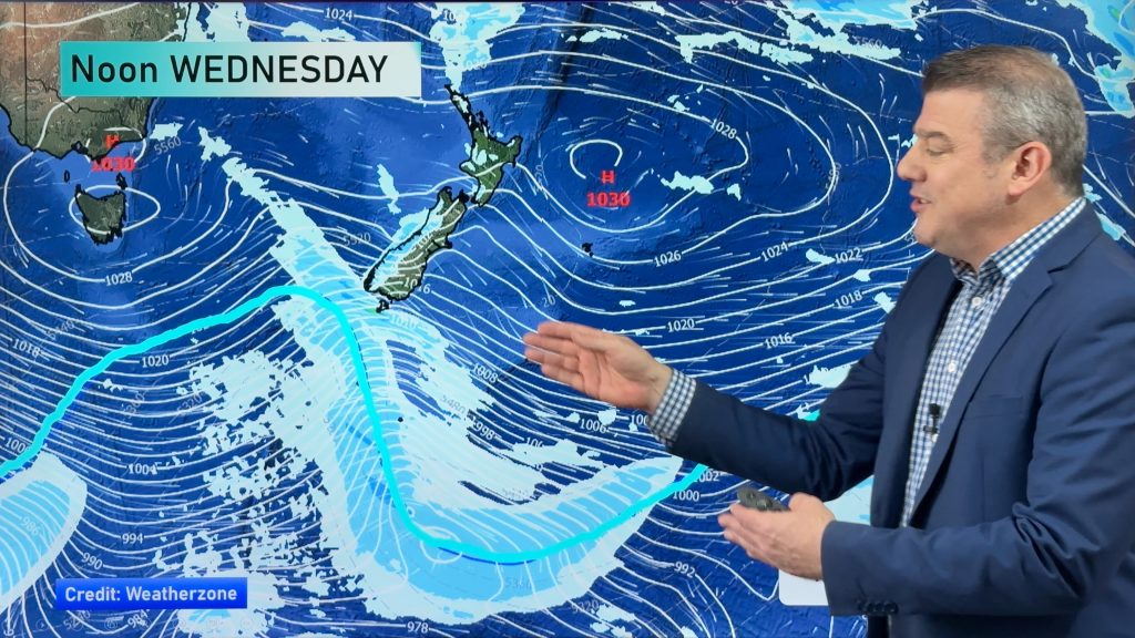
A cold front to brush the south, but high pressure dominates
Today’s video is short and sharp because there isn’t a lot of weather on the way! A cold front will…


Add new comment
Anne on 21/04/2026 7:39pm
Thurs 23, says 0% chance of 5.5 ml of rain …
I realise that forecasts are only a ‘best guess’ and can change at any time, but this seems to me on of the weirder ones, would love to know if there is an explanation
Reply
WW Forecast Team on 21/04/2026 8:07pm
Hi Anne, our rainfall data each day in the daily totals is actually broken into two segments: Daytime and nightime. So if you see that it means rainfall will be occuring overnight. If you use the rain graphs at RuralWeather.co.nz or in the WeatherWatch App you will be able to make more sense of it.
Kind regards
– WW
Reply
View more comments