Weather Forecast for Levin34m above sea level
Now
Today
Tonight
Next 24 Hours in Levin
Next 9 Days in Levin
Day
Night
22km/h
chance
of rain
20.3mm
Day
Night
22km/h
chance
of rain
14.3mm
Day
Night
20km/h
chance
of rain
3.5mm
Day
Night
28km/h
chance
of rain
1mm
Day
Night
29km/h
chance
of rain
19mm
Day
Night
28km/h
chance
of rain
35.1mm
Day
Night
15km/h
chance
of rain
14.7mm
Day
Night
13km/h
chance
of rain
10.1mm
Day
Night
20km/h
chance
of rain
7.3mm
Comments
If you have any questions about functionality of our website(s) or app, trying to locate maps or data, or have a simple comment/feedback - please post a comment below!
As of 2024 we will no longer be publishing questions related to weather forecasts if they are answered via our hyper-local hourly & 10 day forecasts, weather maps and regular daily and monthly weather & climate videos.
We’re a small NZ business with limited resources to respond to general weather questions. Our social media pages may be helpful to you, especially if you want to often talk (or groan!) about your local weather. You can find more resources from us here if that’s your thing.
Have questions of a commercial nature? Contact us directly here.
Thanks for your support!
Don’t forget to check out our RuralWeather.co.nz website (great for event planning or attending + camping!) and also, our brand new Weather Alerting App!
Latest Video
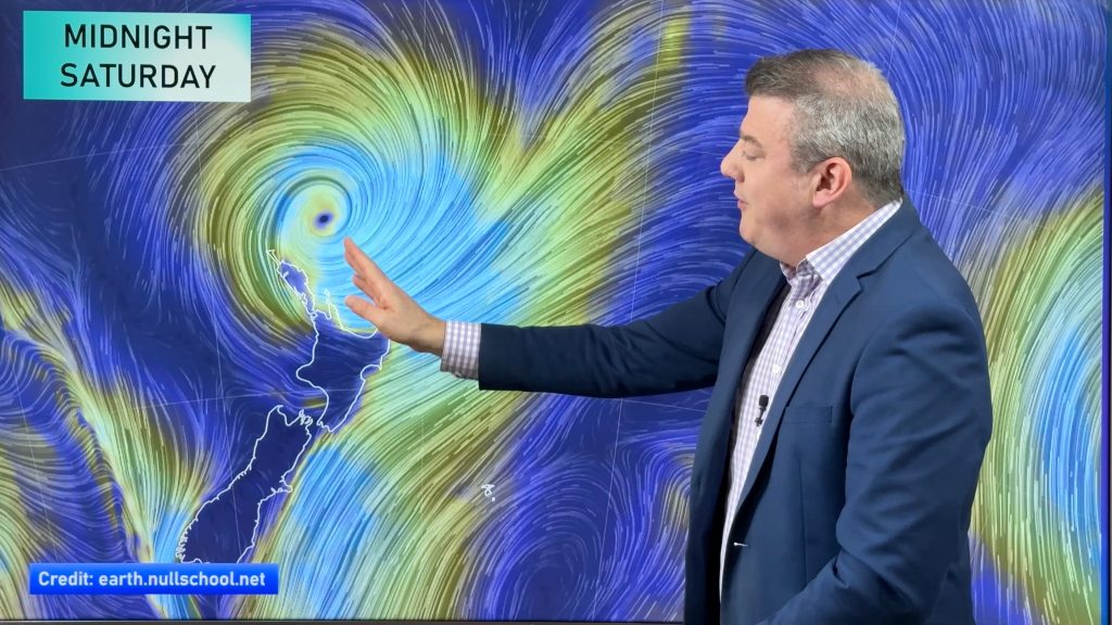
NZ (SAT): Updated forecast for Cyclone Vaianu
We have the latest tracking of Vaianu as the subtropical cyclone moves into the upper North Island tonight, and across…


Add new comment
Kathy on 11/04/2026 7:17am
Great website for current weather – not sure there are any others as good
Reply
Bruce on 11/04/2026 12:00am
Under Maps and Radar > Wind > MajicWeather Wind Forecast. The colour is based on the surface (2m) temperature, and varies from dark blue below freezing, up to green at around 10-15°c, yellow around 25-30°c and red at about 40°c.
Am I correct in assuming that the light colour (white) between the green and yellow is approximate temperature of around 16-24, or is it just light yellow?
Reply
WW Forecast Team on 11/04/2026 4:10am
Hi Bruce, the white (brightness) areas represent the strength of the wind, being severe gale and above – not the temperature. Hope that helps.
Cheers
– WW
Reply
Abigail on 10/04/2026 3:25am
Hi Phil and team WeatherWatch!
Always love and appreciate your work and your informative and calm forecasts.
Quick q about the rain totals for Auckland broken down hourly – the break down is done from 7am-6am but the overall total is done by the day – so Saturday 11 April has a very high rain total but when you break it down by hour the worst of it kicks off from about 1am onwards which technically informs the total for the day, for Sunday 12 April.
So at first glance Saturday’s total rain total for the day looks worse than Sunday’s….until you break it down by hour.
Also do you expect these totals to change tomorrow as they have been mostly consistent-ish for the last few days based on the modelling I assume?
Thanks,
Abigail
Just wondering if this is intentional?
Reply
WW Forecast Team on 10/04/2026 11:32am
Hi Abigail, thanks for your message. The way we receive the data comes in 12 hour blocks so there is basically a daytime rainfall and a nightime rainfall, so rain that is coming in overnight can show up in the prior day’s rainfall total. In our app and at RuralWeather.co.nz you can better see the rainfall in graph form so that it’s much clearer as to when that rain will fall, and how heavy it will be.
As for the totals to change – yes – because the centre of this cyclone is coming in near Auckland the precise tracking of that centre matters a lot at working out heaviest rain and strongest winds. Cyclones can wobble left and right and that may shift the future tracking, and therefore your rainfall. Our data updates each hour, so worth keeping an eye on. MetService warnings cover what is possible though and as with any rainband if it slows down the forecast rainfall totals will increase, if the storm moves faster that will decrease rainfall. Quite a few moving parts to it all!
– WW
Reply
Carla on 9/04/2026 10:45pm
Hi Phil, Can you explain why the windspeeds for the incoming cyclone differ considerably between your rural weather forecast and the Met office warnings?
I have looked at the Whangarei wind forecast for Saturday and Sunday and it is 39km/h with gusts of up to 71km/h max on Saturday and and 40km/h with gusts of 74km/h max on Sunday.
The Met office predicts from 11pm Sat, 11 Apr – 2pm Sun, 12 Apr: Severe gale southeasterlies changing to severe gale southwesterlies during Sunday afternoon, gusting 130km/h in exposed places. Moderate chance of upgrading to a Red Warning.
Since we overlook the sea we do get more rain and wind than Whangarei itself sometimes, so I looked up Taiharuru as well and there the wind is 47km/h with 78km/h gusts.
From past experience I know that they tend to try and cover all eventualities, however this seems to be a big gap this time.
Any ideas?
Reply
WW Forecast Team on 10/04/2026 1:27am
Hi Carla, the MetService warnings are for the region you are in, with highest wind speeds and rainfall quite often in more exposed places (mountains, ranges, islands, extreme coastal areas) – hence their higher numbers as warnings capture what is POSSIBLE as well as what is LIKELY. Our data tries to look at what is likely, but in any storm event you can double your wind gusts or rainfall to get an idea as to what more exposed areas might be getting.
Our data also updates each hour, which on the day itself can be very helpful – and also can see our own numbers lift as data gets more locked in.
– WW
Reply
View more comments