
> From the WeatherWatch archives
UPDATED 6:36am — On Wednesday we are about to see things ramp up a few notches, with a very wet northwesterly airstream over the country.
This will result in what will probably be torrential rain for the West Coast of the South Island, right through the Southern Alps into the eastern divide a little. As of 6:30am rain was only patchy – but it is likely to intensfy and for some parts of the West Coast, especially in the mountains, flooding rains are possible. Government forecast MetService now says up to half a metre of rain might fall.
A front slowly then moves northwards up the South Island, before reaching the lower North Island later on Thursday.
While flooding is not forecast to be widespread, much of the West Coast is exposed to the possibility of torrential rain over the next 24 hours and all Coasters should be aware of the latest warnings and watches issued by MetService.
For most other places – today is business as usual for mid-Autumn.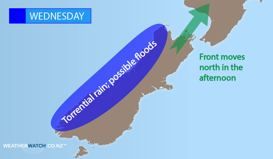 Winds ahead of the front are typically a strong north-norwesters, then easing after the front clears.
Winds may tend a little more to the west after the front moves through, but there isn’t a lot of a major wind change with this front – just rain activity in the main.
– Aaron Wilkinson & Drew Chappell, WeatherWatch.co.nz
Latest Video

Westerly change this week, unsettled but large dry areas
Westerlies kick back in again this week which will bring a break to those in the east as far as…
Related Articles
Westerly change this week, unsettled but large dry areas
Westerlies kick back in again this week which will bring a break to those in the east as far as…

Matariki, the long weekend + the outlook for next week
Wet weather and cloud continues along the eastern side of the country with the heaviest rain now moving into northern…

More eastern rain, but a drier long weekend coming
Rain continues today along the eastern South Island and lower North Island, coming in from the east with heavy falls….

