
> From the WeatherWatch archives
Most of the weather across New Zealand today isn’t severe but there are a couple of pockets to keep an eye on, rain and wind-wise.
Rain looks to be the main feature today, although gales in some areas are still blowing.
RAIN
Rain-wise the heaviest falls are moving from Waikato to Bay of Plenty southwards. This area has the heaviest and slowest moving downpours at the moment as you can see in the image below.
In the South Island some rain is approaching the north-east and heavy falls are possible later.
Those in the path of this rain should be aware of it as localised flooding is possible (at the lower end of the scale generally speaking).
 10:36am rain radar – areas in bright blue show the heaviest rain, yellow = light or drizzle. Radar owned by the NZ Govt, funded by the NZ Taxpayer.
WIND
The strongest winds remain through the Cook Strait area on Friday. Overnight last night gales pushed through and today that very strong southeast flow continues to be funnelled through at a decent speed.
It may be a little hard to see in the 12noon Friday wind map below but the strongest winds (Orange) are mostly through Cook Strait or out at sea and will gradually ease across the day in the Cook Strait area.
The next burst of wind looks likely to come on the back end of the low (which you can see around northern NZ out in the Tasman Sea). The rea coloured in red and purple indicates gales at times.
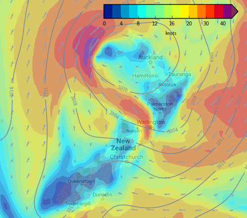 (12Noon / Weathermap)
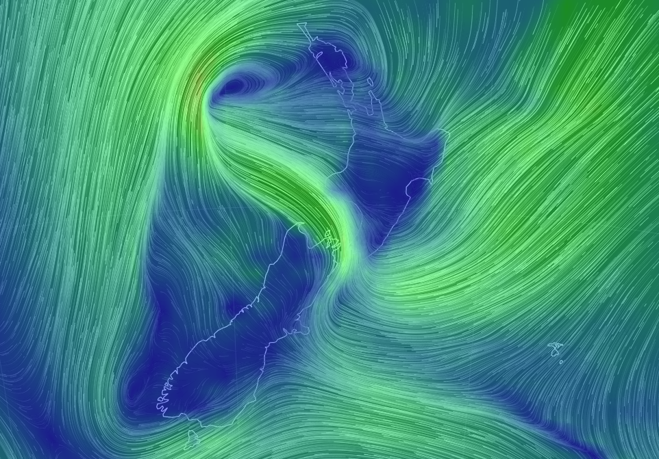 Current (9am) wind map / Earth
Look out for our weekend video forecast and sub-tropical low update early this afternoon.
– WeatherWatch.co.nz
Latest Video

Cold weekend, frosts return with high pressure, then a low late next week
The subantarctic airflow spreads over NZ today/tonight and into Saturday, dropping temperatures nationwide. Snow flurries are possible today to lower…
Related Articles
Cold weekend, frosts return with high pressure, then a low late next week
The subantarctic airflow spreads over NZ today/tonight and into Saturday, dropping temperatures nationwide. Snow flurries are possible today to lower…

Wintry burst of weather: Snow, squally showers then sunshine & frosts
A polar change (another one!) arrives on Friday for the South Island and goes nationwide on Saturday, leaving NZ under…

Antarctic southerly for parts of NZ Fri & Sat
For the first time this year a southerly from off Antarctica is heading towards the South Island, followed by more…

