The two sides of New Zealand – The Big Picture on Thursday
30/03/2016 4:00am

> From the WeatherWatch archives
On Thursday we have an anticyclone which starts over the country in the morning, then slowly moves eastwards during the day.
A northeasterly airflow gradually increases around New Zealand, and while it doesn’t become strong or anything, it may be a bit breezy about Auckland and Northland – especially from the afternoon onwards.
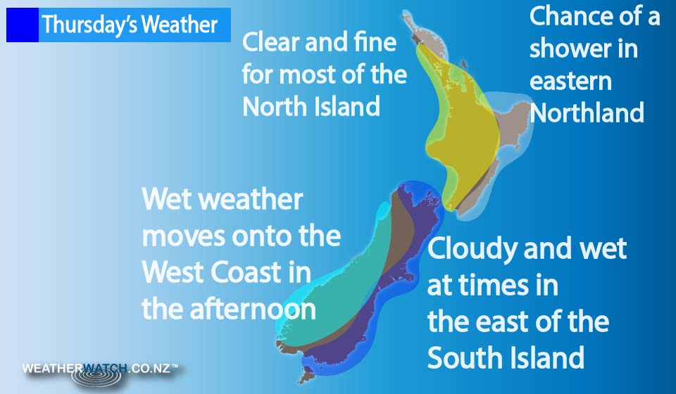
Fairly sunny skies dominate the east of both islands, with high cloud increasing from morning.
Eastern parts of the North Island may see some morning lower level cloud though, clearing away by afternoon.
Not too much shower activity anywhere in the North Island, although there may be a shower or two about eastern Northland from afternoon – otherwise it’s looking mainly dry.
In the west of the country, cloud thickens from morning, and showers move onto the West Coast of the South Island – from Hokitika southwards – in the afternoon, then push northwards overnight.
Nelson may see a shower move in overnight too.
Eastern parts of the South Island (from Southland through to Marlborough) sees scattered areas or spots of rain and showers spread from the west by dawn on Friday.
– Aaron Wilkinson & Drew Chappell, WeatherWatch.co.nz
Comments
Before you add a new comment, take note this story was published on 30 Mar 2016.
Latest Video

(VIDEO) NZ 7 Day: Variety in the weather, but Southern Ocean storms waking up
Low pressure moves in to NZ from the Tasman Sea this weekend and completely falls apart – bringing downpours and…
Related Articles
(VIDEO) NZ 7 Day: Variety in the weather, but Southern Ocean storms waking up
Low pressure moves in to NZ from the Tasman Sea this weekend and completely falls apart – bringing downpours and…

VIDEO: ClimateWatch: July is the month of BIG lows, BIG highs
This month around New Zealand, Australia and the region we see big highs and big lows – bringing decent stretches…

VIDEO: Severe weather risks for NZ as low moves in
Programming Note: Apologies but we have no video on Thursday – back again on Friday! – A storm in the…


Add new comment