Strong northwesterly – The Big Picture on Wednesday
6/10/2015 5:04am

> From the WeatherWatch archives
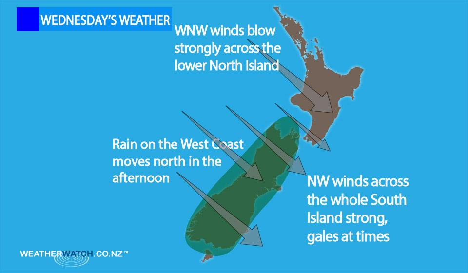
A strong northwesterly airflow lies over the country on Wednesday, while a front moves onto the lower South Island in the mid to late afternoon, before heading north in the evening.
South Island
It’s looking cloudy for the west of the South Island, with rain about South Westland from afternoon, then spreading northwards in the evening.
Plenty of high cloud develops in the east in the morning.
Winds over the whole South Island are strong from the northwest with gales in the east as per the risk email.
North Island
Mostly sunny weather pretty much everywhere, with cloud increasing about Taranaki through to Kapiti in the evening, and west to northwesterly winds becoming a little gusty at times from Taranaki through to Kapiti, and Wellington and Wairarapa from afternoon.
– Aaron Wilkinson & Drew Chappell, WeatherWatch.co.nz
Comments
Before you add a new comment, take note this story was published on 6 Oct 2015.
Latest Video

(VIDEO) NZ 7 Day: Variety in the weather, but Southern Ocean storms waking up
Low pressure moves in to NZ from the Tasman Sea this weekend and completely falls apart – bringing downpours and…
Related Articles
(VIDEO) NZ 7 Day: Variety in the weather, but Southern Ocean storms waking up
Low pressure moves in to NZ from the Tasman Sea this weekend and completely falls apart – bringing downpours and…

VIDEO: ClimateWatch: July is the month of BIG lows, BIG highs
This month around New Zealand, Australia and the region we see big highs and big lows – bringing decent stretches…

VIDEO: Severe weather risks for NZ as low moves in
Programming Note: Apologies but we have no video on Thursday – back again on Friday! – A storm in the…


Add new comment