Spring hanging around – The Big Picture on Thursday
2/12/2015 4:46am

> From the WeatherWatch archives
On Thursday we have a strong northwesterly airflow over the South Island, and a front within this flow moving north during the day.
Winds will change to the southwest behind the front – for the most part.
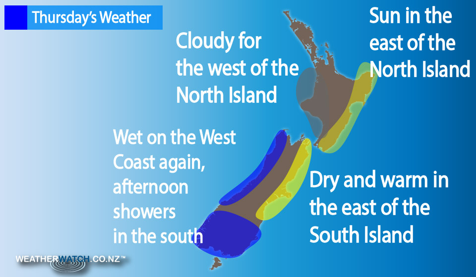
The North Island sits under a north to northwesterly airflow, while a high still sits out to the east of the North Island in the Pacific Ocean.
It’s shaping up to be a mostly cloudy day for the North Island in the west, but some sun is possible, especially in the afternoon.
Staying mainly sunny in the east (Gisborne to Wairarapa), with some high cloud which thickening later in the day.
There’s rain for the West Coast of the South Island – becoming heavy at times, especially afternoon and evening, as a front moves through.
It’s looking dry in the east, with thickening high cloud from morning, gusty north to northwesterly winds strong for inland areas in the afternoon.
Rain or showers from around midday about Southland and Otago as a southwest change moves through, mostly clearing by evening.
– Aaron Wilkinson & Drew Chappell, WeatherWatch.co.nz
Comments
Before you add a new comment, take note this story was published on 2 Dec 2015.
Latest Video

(VIDEO) NZ 7 Day: Variety in the weather, but Southern Ocean storms waking up
Low pressure moves in to NZ from the Tasman Sea this weekend and completely falls apart – bringing downpours and…
Related Articles
(VIDEO) NZ 7 Day: Variety in the weather, but Southern Ocean storms waking up
Low pressure moves in to NZ from the Tasman Sea this weekend and completely falls apart – bringing downpours and…

VIDEO: ClimateWatch: July is the month of BIG lows, BIG highs
This month around New Zealand, Australia and the region we see big highs and big lows – bringing decent stretches…

VIDEO: Severe weather risks for NZ as low moves in
Programming Note: Apologies but we have no video on Thursday – back again on Friday! – A storm in the…


Add new comment