
> From the WeatherWatch archives
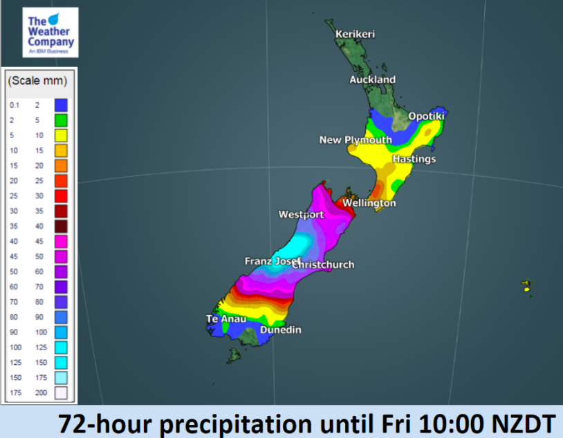
Persistent wet weather is going to affect the West Coast with big fluctuations in daytime temperatures for some in the south too.
The second week of 2018 is dominated by a developing area of low pressure over the South Island pushing patchy areas of rain and showers around the island and even into parts of the North Island by the end of the week.
Temperatures will be a bit flat for some due to this localised low, cloud and cooler winds at times. Some places will only have daytime highs in the late teens, but by this weekend inland parts of Southland and Otago will be closer to 30 degrees.
More rain is also coming to the dry West Coast – this will be welcome news to many.
Elsewhere expect more consistent temperatures and mainly dry weather, especially the upper North Island, however it may be a bit cloudy at times this week.


– WeatherWatch.co.nz (An official IBM business partner)
Comments
Before you add a new comment, take note this story was published on 8 Jan 2018.
Latest Video

(VIDEO) NZ 7 Day: Variety in the weather, but Southern Ocean storms waking up
Low pressure moves in to NZ from the Tasman Sea this weekend and completely falls apart – bringing downpours and…
Related Articles
(VIDEO) NZ 7 Day: Variety in the weather, but Southern Ocean storms waking up
Low pressure moves in to NZ from the Tasman Sea this weekend and completely falls apart – bringing downpours and…

VIDEO: ClimateWatch: July is the month of BIG lows, BIG highs
This month around New Zealand, Australia and the region we see big highs and big lows – bringing decent stretches…

VIDEO: Severe weather risks for NZ as low moves in
Programming Note: Apologies but we have no video on Thursday – back again on Friday! – A storm in the…


Add new comment