NOVEMBER’S LAST WEEK: More inland thunderstorms, deluges, coastal clouds (+2 Maps)
26/11/2017 5:46am

> From the WeatherWatch archives
The final week of November will have a similar set up every day as the high that brought a dry week last week remains with New Zealand.
The main centre of this high shifts eastwards from the Tasman Sea to the Pacific Ocean and this will encourage more easterly quarter winds into many areas but sea breezes will still be in the mix too. This will mean a continuation of the cloudier weather for many areas.
Each day there will be a downpour risk inland, with some chance of isolated but significant thunderstorms. These are most likely well inland in both islands near/around the ranges and plateaus (Central Plateau/eastern Ranges in the North Island and mainly the ranges of Otago and Canterbury in the South Island).
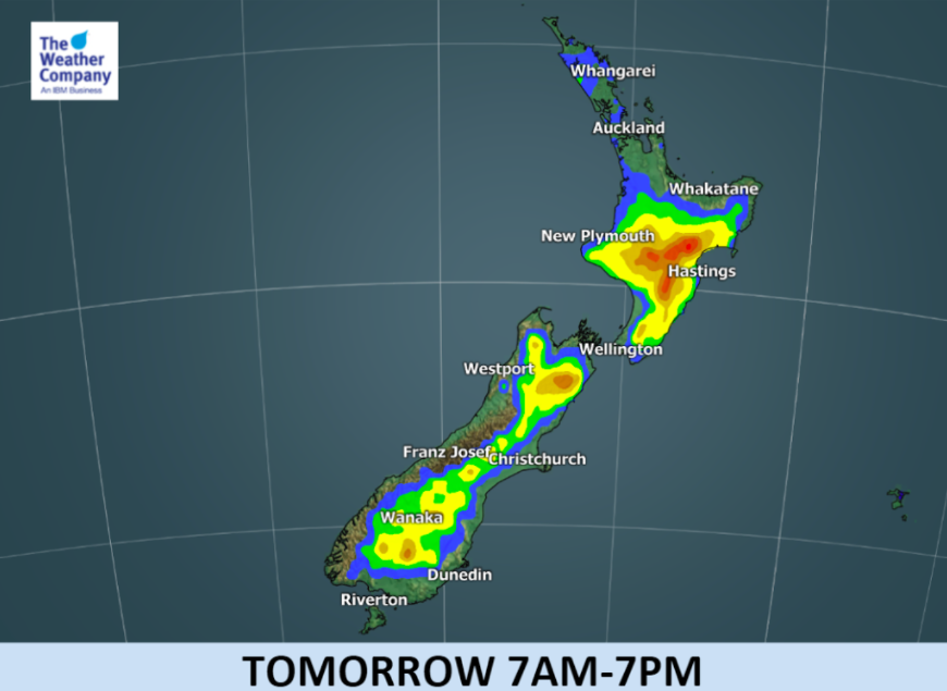
As the large high changes shape and size slightly across the coming week (anticyclones tend to ‘breathe’, growing and shrinking as they drift around the globe) this will slightly alter wind directions inland here in New Zealand and so each day the risk of downpours shifts around a bit. Most days the risk area remains inland and on some days this week the rain risk areas each afternoon even, somewhat, mimic the nation’s outline, a bit like this future rain radar image for Wednesday:
Most of the main centres will be dry or mainly dry in this set up. But keep an eye on the forecasts in case any of these downpours look likely to pop up nearer to them, or if they drift that way in the late day breezes.
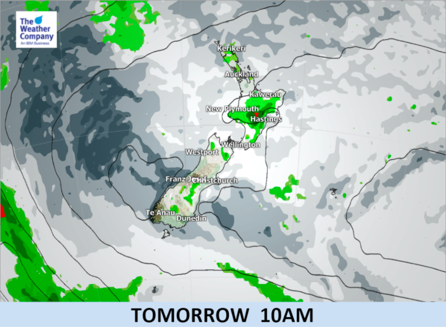
Here’s the latest for how the week kicks off weatherwise on MONDAY:

– Maps by The Weather Company (An IBM business and an official WeatherWatch.co.nz business partner)
– WeatherWatch.co.nz
Latest Video

Cold weekend, frosts return with high pressure, then a low late next week
The subantarctic airflow spreads over NZ today/tonight and into Saturday, dropping temperatures nationwide. Snow flurries are possible today to lower…
Related Articles
Cold weekend, frosts return with high pressure, then a low late next week
The subantarctic airflow spreads over NZ today/tonight and into Saturday, dropping temperatures nationwide. Snow flurries are possible today to lower…

Wintry burst of weather: Snow, squally showers then sunshine & frosts
A polar change (another one!) arrives on Friday for the South Island and goes nationwide on Saturday, leaving NZ under…

Antarctic southerly for parts of NZ Fri & Sat
For the first time this year a southerly from off Antarctica is heading towards the South Island, followed by more…

