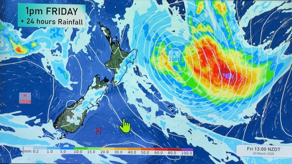
New Zealand: Expected rainfall totals across Friday and Saturday (+8 Maps)
11/01/2018 9:13pm

> From the WeatherWatch archives
A weak area of low pressure in the eastern Tasman Sea will fall apart today but lend a helping hand to creating afternoon downpours and thunderstorms in the North Island’s interior and some more wet weather in the west.
The leftovers of this weak low, along with a humid northerly flow on Saturday, will see further chances of afternoon downpours through the North Island, some with thunder.
A bit more rain will return to Greymouth, but not at the levels seen yesterday.
The Main Highlights:
- The low can not move eastward, because the high pressure in the South Pacific Ocean will gradually be stronger. The low will fall apart today.
- This set up is the reason why eastern areas remain fairly dry.
- Onshore breeze around the high will produce thunderstorms over the mountains of the North island by tomorrow.
- There will be risks of localized heavy rain and lightning.
- The stronger high, however, may bring dry weather in most areas tomorrow and Sunday.
- This unsettled pattern continues next week – the next low with unstable air is expected to approach New Zealand early next week.


– Maps by The Weather Company (an IBM business)
– WeatherWatch.co.nz (an official IBM business partner)
Comments
Before you add a new comment, take note this story was published on 11 Jan 2018.


Add new comment