More of the same, but less so – The Big Picture on Friday
24/09/2015 5:00am

> From the WeatherWatch archives
On Friday we still have a southeasterly airflow lying over the whole of NZ, with conditions calming down a little.
North Island
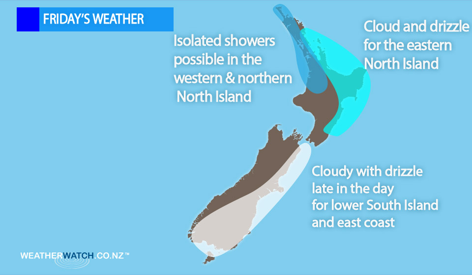
Sunny areas in the west, but a few isolated showers possible afternoon and evening Waikato northwards.
The chance of a heavy fall about Northland, while winds come from the southeast.
For the East Coast, it’s looking cloudy with rain and drizzle.
Fairly cloudy for Wellington, with only the chance of a light shower now and then, while from Kapiti to Taranaki in the west it’s looking like sunny areas, with cloud less prominent the further one travels west.
South Island
A mainly sunny day on the West Coast.
There will be sunny areas at first about Southland and Otago, then southerly winds pick up in the afternoon bringing cloud and drizzle.
This gradually pushes further north, reaching Canterbury in the evening.
Marlborough and Nelson see sunny areas with east to southeasterly winds, cloud more prominent about Marlborough especially in the morning.
– Aaron Wilkinson & Drew Chappell, WeatherWatch.co.nz
Comments
Latest Video

Cold weekend, frosts return with high pressure, then a low late next week
The subantarctic airflow spreads over NZ today/tonight and into Saturday, dropping temperatures nationwide. Snow flurries are possible today to lower…
Related Articles
Cold weekend, frosts return with high pressure, then a low late next week
The subantarctic airflow spreads over NZ today/tonight and into Saturday, dropping temperatures nationwide. Snow flurries are possible today to lower…

Wintry burst of weather: Snow, squally showers then sunshine & frosts
A polar change (another one!) arrives on Friday for the South Island and goes nationwide on Saturday, leaving NZ under…

Antarctic southerly for parts of NZ Fri & Sat
For the first time this year a southerly from off Antarctica is heading towards the South Island, followed by more…


Zelda Wynn on 24/09/2015 6:58am
SE winds have been kind to us in New Lynn. A treat watching mountainous cumulus form S of Manukau harbour and feed out to the Tasman sea. Magnificent clouds provided a stunning backdrop to New Lynn.