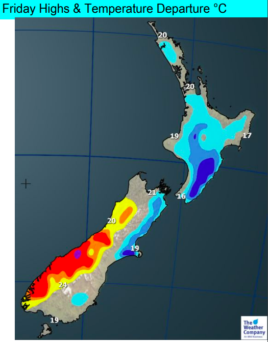
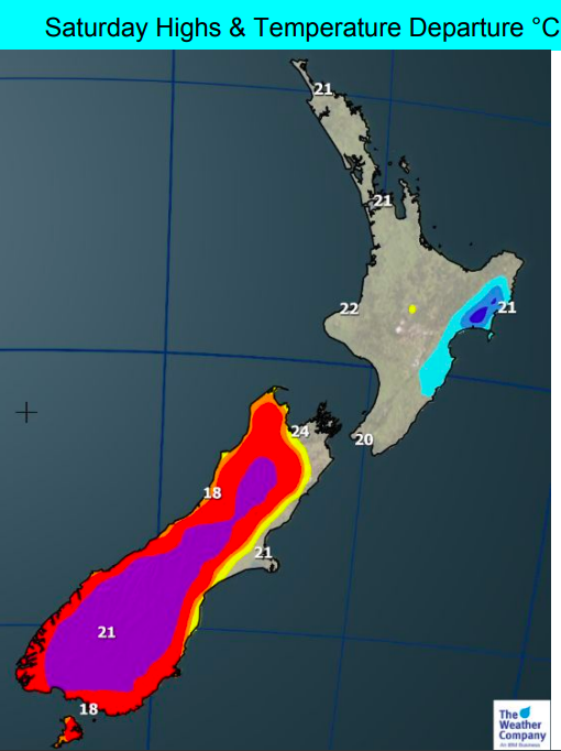
Maps (x4) – Temperatures compared to normal from Thursday to Sunday…cool then warm
4/12/2018 11:04pm

We have a colder change spreading up the South Island today and the North Island on Thursday and will make a number of regions colder than normal for this time of the year. But it won’t remain – with warmer than average weather returning by the weekend.
The temperature surges are very ‘spring-like’ which, in December, can be very normal. If you’re a fan of the astronomical dates for seasons then technically it’s still spring – with summer not officially starting until December 22nd.
The good news it that we do have more high pressure rolling in for the end of the week and weekend, bringing mostly settled and dry weather (but sorry Southland, you may have more showers or patches of rain this weekend – but you are surrounded by dry days on Friday and Monday to make up for it).
DEPARTURE FROM NORMAL TEMPERATURE MAPS… in other words, how much colder or hotter is it compared to normal for this time of the year


– WeatherWatch.co.nz
Comments
Latest Video

Weekend Newsfeed: Warmer than average ahead of large low next week(+5 Maps)
Next week subtropical and subantarctic airflows will meet over NZ – and the forecast is still yet to be locked…
Related Articles
Weekend Newsfeed: Warmer than average ahead of large low next week(+5 Maps)
Next week subtropical and subantarctic airflows will meet over NZ – and the forecast is still yet to be locked…

VIDEO: NZ’s weather for the rest of July as large low looms again
High pressure and warm nor’westers are the theme of July’s final weekend – and the final week looks to be…

Thursday Newsfeed: High pressure moves closer to NI
High pressure over the Tasman Sea moves closer to the North Island encouraging milder nor’westers from Australia into the South…


Add new comment