
> From the WeatherWatch archives
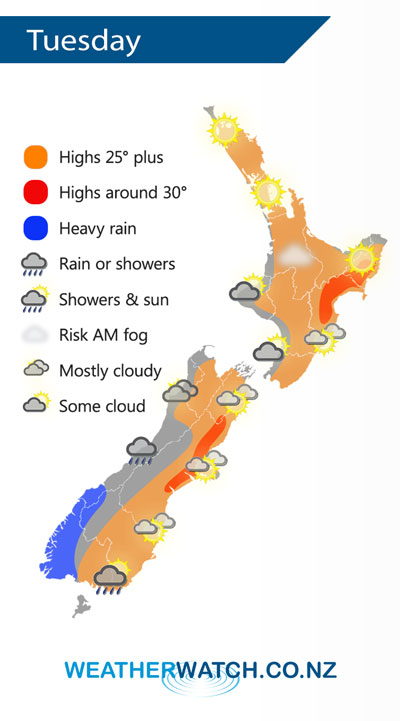
An anticyclone lies to the east of New Zealand on Tuesday casting a ridge of high pressure back over the North Island, northwesterlies build over the South Island with a cold front moving into Fiordland / Southland during the evening.
Mostly sunny for most North Island regions on Tuesday, some morning cloud is possible in the southwest. Also watch for the chance of some early low cloud or fog for inland areas.
Cloudy for the West Coast of the South Island with a few showers, rain about Fiordland becomes heavy from afternoon. The odd spit possible for Southland then rain moves in during the evening possibly heavy.
By Weather Analyst Aaron Wilkinson – WeatherWatch.co.nz
Latest Video

Matariki, the long weekend + the outlook for next week
Wet weather and cloud continues along the eastern side of the country with the heaviest rain now moving into northern…
Related Articles
Matariki, the long weekend + the outlook for next week
Wet weather and cloud continues along the eastern side of the country with the heaviest rain now moving into northern…

More eastern rain, but a drier long weekend coming
Rain continues today along the eastern South Island and lower North Island, coming in from the east with heavy falls….

More heavy rain, snow – but large dry areas, especially as we go into the long weekend
Heavy rain will continue for parts of Canterbury and Marlborough over the next day or two and it will gradually…

