
> From the WeatherWatch archives
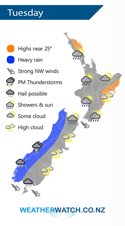
A cold front pushes northwards over the South Island early on Tuesday then the North Island in the afternoon and evening, meanwhile another cold front lands onto the lower South Island in the afternoon.
Bouts of heavy rain can be expected for the West Coast of the South Island on Tuesday morning then from afternoon a further surge of cold air brings showers with a chance of thunderstorms and hail about the lower South Island.
Further north a period of showers may become heavy about the western North Island for a time in the afternoon / evening. Conditions for eastern New Zealand are mainly dry and sunny, overnight a southwest change moves through Otago and perhaps South Canterbury which could bring heavy showers and hail.
By Weather Analyst Aaron Wilkinson – WeatherWatch.co.nz
Latest Video

Wintry weather coming: Snow, rain, wind & sunshine
A cold front is moving into NZ from Friday to Sunday with low pressure developing west of NZ and then…
Related Articles
Wintry weather coming: Snow, rain, wind & sunshine
A cold front is moving into NZ from Friday to Sunday with low pressure developing west of NZ and then…

ClimateWatch: JULY outlook & what El Niño means for NZ
El Niño is officially here and still getting stronger in the months ahead, but it’s harder to notice its effects…

Low pressure heading to NZ this weekend & into next week
Many regions have settled weather at the moment with frosts as far north as Auckland this morning, but still some…

