
> From the WeatherWatch archives
Tropical Cyclone Bune still remains a dangerous category 2 cyclone this morning as the outer bands now reach East Cape and Gisborne – as mostly high cloud.
The storm walloped Raoul Island overnight with seismographic, meteorological and some sea data all going offline. All has been restored now and the tsunami gauge clearly shows the storm surge as the giant eye passed over causing a strong vacuum affect on the sea.
![]()
The past 36 hours clearly shows the dome last night on Raoul Island as the eye of Bune passed nearby, creating a significant storm surge / GeoNet
This morning winds are still sustained at 110km/h around the centre of Bune, still making it a powerful category 2 cyclone with the air pressure 975hPa. However overnight the clear eye formation has been shredded, a sign that the cyclone is now in decay.
But despite it going through extra-tropical transition (when it ceases to be a “tropical cyclone” and becomes a more “normal” storm for this latitude) it is still a dangerous storm and is already bringing rough surf, seas and rips to the east coast.
The cyclone – or ex-cyclone – will be at its closest point to East Cape and Gisborne from noon Wednesday to noon Thursday as it continues its very slow track southward.
WeatherWatch.co.nz still has low confidence of any severe weather for New Zealand but a stregnthening south east flow will develop over the north eastern North Island with a 60% chance of rain around East Cape and Gisborne later tomorrow night and on Thursday.
– WeatherWatch.co.nz
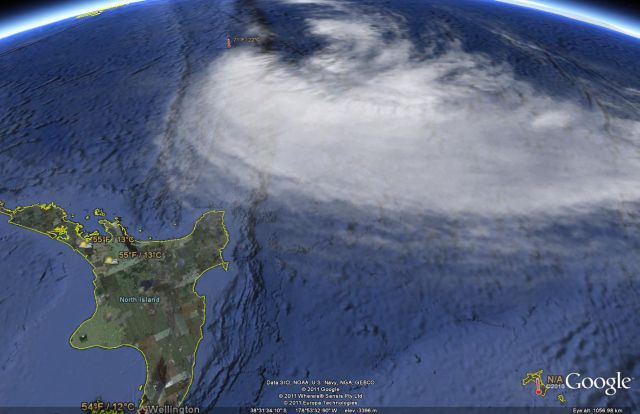
Latest Sat Map of Bune / Google
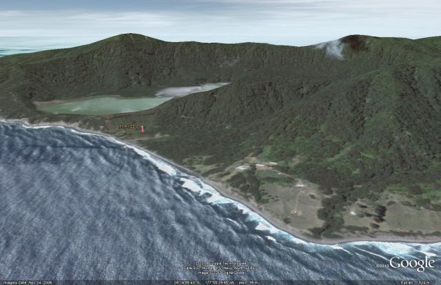
Raoul Island – buildings (centre right) are well above sea level. Recording equipment, centre left, towards crater / Google. This image is facing south east.
– WeatherWatch.co.nz
Comments
Latest Video

Cold weekend, frosts return with high pressure, then a low late next week
The subantarctic airflow spreads over NZ today/tonight and into Saturday, dropping temperatures nationwide. Snow flurries are possible today to lower…
Related Articles
Cold weekend, frosts return with high pressure, then a low late next week
The subantarctic airflow spreads over NZ today/tonight and into Saturday, dropping temperatures nationwide. Snow flurries are possible today to lower…

Wintry burst of weather: Snow, squally showers then sunshine & frosts
A polar change (another one!) arrives on Friday for the South Island and goes nationwide on Saturday, leaving NZ under…

Antarctic southerly for parts of NZ Fri & Sat
For the first time this year a southerly from off Antarctica is heading towards the South Island, followed by more…


Celtickiwi on 29/03/2011 1:42am
There was a light pinkish red ring around the sun earlier. I was told some years ago by an elder that it ment a major weather event was coming.
I enjoy learning these things from our old folk. They had to be so observant in their day that they would note these things and link them up with these events. Pretty cool, pretty cool indeed I reckon.