> From the WeatherWatch archives
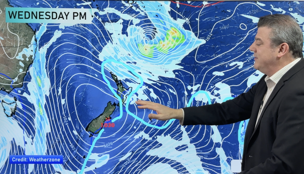
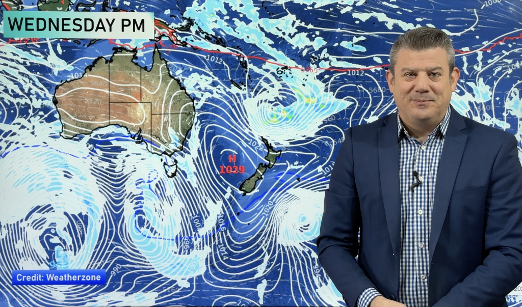
A belt of high pressure is dominating New Zealand, keeping both Tasman and tropical rainmakers away which is a change to the weather pattern we had in February and half of March.
A series of tropical lows are forming at the moment and into next week but a belt of high pressure over New Zealand should continue to keep these well to our north. The belt of high pressure is mainly centering and tracking over the North Island, with the southern side of this high pressure crossing the South Island with westerly winds bringing rain to the West Coast regularly and sometimes windy west to north west winds to other regions.
It’s this westerly flow that yesterday pushed Hawke’s Bay in to the 30s temperature-wise. It may happen again today.
These highs will encourage another week or two of mainly dry weather around New Zealand which, on a yearly average point of view, is a helpful breather after the extra wet weather in the second half of summer.
A cold southerly on Sunday this weekend and into Monday and Tuesday next week will see snow falling on the mountains in both islands and single digit daytime temperatures for some in the southern half of the South Island. But more high pressure looks to be coming in behind it.
WeatherWatch.co.nz says with warmer than average sea surface temperatures around New Zealand the active cyclone season may extend beyond it’s normal end date of April 30th this year, with tropical cyclones and lows still possible into May.
It won’t be perfectly dry for all regions – most regions will get showers at some point and/or some patchy rain in the next couple of weeks. But the grand totals may not be all that grand unless a low pressure system can penetrate this hig pressure belt and deliver soaking rains beyond just the West Coast.
The high pressure belt is currently producing westerlies for New Zealand which bumped Hawke’s Bay up over 30 degrees on Tuesday and may get close to 30 degrees again today Wednesday, which would be over 8 degrees warmer than average for this week. A cold snap arrives this weekend and early next week bringing snow to the mountains in both islands followed by more big high pressure early to mid next week.

– How much hotter will this afternoon be compared to usual? Hawke’s Bay may be 8+ degrees above normal / The Weather Company.
 – Next 7 days shows drier than average (in pink and red), normal rainfall in white and heavier than usual rainfall in blue (the deeper the blue the wetter it will be). Data by the US Government.
– WeatherWatch.co.nz
Comments
Before you add a new comment, take note this story was published on 4 Apr 2018.


Add new comment