
> From the WeatherWatch archives
On Wednesday we have a ridge of sorts sitting over New Zealand, extending out from a high in the Tasman Sea, while from afternoon, a northwesterly airflow starts to build over the South Island.
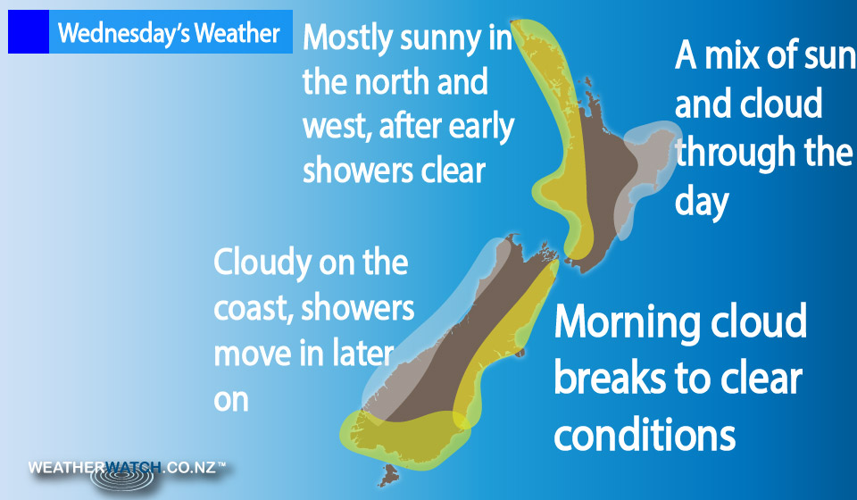
In the North Island we have a mix of sunny areas and some cloud in the west, after any morning showers clear.
Winds are breezy from the west or southwest for the most part.
The Bay Of Plenty is mainly sunny, with southwesterly winds in the morning, tending more from the north in the afternoon.
For the East Coast, from Gisborne to the Wairarapa, southerly breezes bring cloudy periods and occasional sun – while conditions stay mainly dry – but there could be a shower or two about the Wairarapa.
In the South Island, Marlborough and Nelson both will see cloudy areas during the day, as winds are light tending north to northeast in the afternoon.
Morning cloud breaks from Otago and Canterbury, leaving things mostly sunny with east to northeast winds by afternoon.
For Otago and Southland, high cloud increases from afternoon – and there may be a spit or two later in the evening or overnight.
– Aaron Wilkinson & Drew Chappell, WeatherWatch.co.nz
Comments
Before you add a new comment, take note this story was published on 8 Dec 2015.
Latest Video

(VIDEO) NZ 7 Day: Variety in the weather, but Southern Ocean storms waking up
Low pressure moves in to NZ from the Tasman Sea this weekend and completely falls apart – bringing downpours and…
Related Articles
(VIDEO) NZ 7 Day: Variety in the weather, but Southern Ocean storms waking up
Low pressure moves in to NZ from the Tasman Sea this weekend and completely falls apart – bringing downpours and…

VIDEO: ClimateWatch: July is the month of BIG lows, BIG highs
This month around New Zealand, Australia and the region we see big highs and big lows – bringing decent stretches…

VIDEO: Severe weather risks for NZ as low moves in
Programming Note: Apologies but we have no video on Thursday – back again on Friday! – A storm in the…


Add new comment