Another cold day in store – The Big Picture on Wednesday
3/11/2015 3:31am

> From the WeatherWatch archives
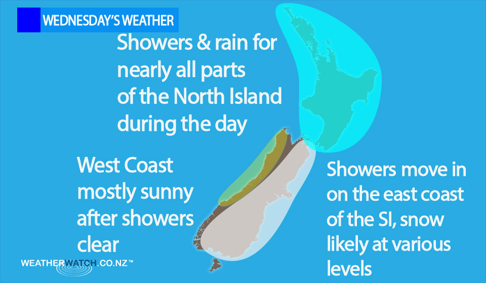
On Wednesday we have an icy southerly airflow still lying over New Zealand, meaning more low temperatures and some cold rain and showers – as well as more snow!
There are showers or rain for most in the east, as well as snow to various levels about Southland, Coastal Otago, and Marlborough at times.
On the other side of the South Island, the West Coast sees early showers mostly clearing then sunny areas increase, and winds from the southeast.
Rain or showers stick around for most regions of the North Island, with southwesterly winds tending south to southeast later in the day – at which point showers ease or perhaps clear for many.
– Aaron Wilkinson & Drew Chappell, WeatherWatch.co.nz
Comments
Before you add a new comment, take note this story was published on 3 Nov 2015.
Latest Video

NZ VIDEO: Severe weather going into the weekend. Next week: Westerlies continue
Heavy rain and northerly gales are moving across NZ going into the weekend as a large low from the Tasman…
Related Articles
NZ VIDEO: Severe weather going into the weekend. Next week: Westerlies continue
Heavy rain and northerly gales are moving across NZ going into the weekend as a large low from the Tasman…

VIDEO: Low pressure, cold fronts, main feature next two weeks
There are several low pressure zones and cold fronts coming into NZ, with westerly driven weather dominating our weather pattern…

VIDEO: Burst of wind and rain for NZ as low pressure dominates
Air pressure around New Zealand will continue to drop in the days ahead as low pressure systems affect our weather…


Add new comment