Amazing winter warmth across the North Island, but cold in the south (+4 Maps)
20/06/2016 2:21am

> From the WeatherWatch archives
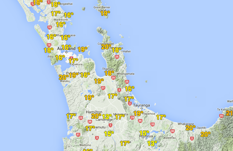
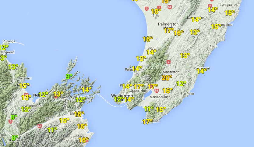
Updated 2:20pm — Temperatures are well above average across the northern parts of the country today – and the entire week ahead, if not two weeks ahead, look warmer than average for the most part. Meanwhile the air becomes much colder from Canterbury southwards, especially inland parts of Otago and Southland.
As of 2:20pm Monday temperatures are in the late teens across much of the North Island with temperatures into the low 20s this hour, like in Northland.
Auckland is also in the late teens, bordering on 20 in some suburbs.
Mild weather spreads down across the country – and will continue to do so over the coming 24 hours.
It’s much colder in the South Island where light winds mean some areas are still in single digits, including parts of Southland, Otago and Canterbury – but warming weather is coming for everyone over Tuesday and Wednesday thanks to a sub-tropical northerly.
As of 2:20pm it was just 4 degrees at Dunedin airport – a stark contrast to Hamilton airport on 18 degrees.


– Temperature/community weather station maps via Wunderground (coming soon to WeatherWatch.co.nz!)
– WeatherWatch.co.nz
Comments
Before you add a new comment, take note this story was published on 20 Jun 2016.
Latest Video

NZ VIDEO: Severe weather going into the weekend. Next week: Westerlies continue
Heavy rain and northerly gales are moving across NZ going into the weekend as a large low from the Tasman…
Related Articles
NZ VIDEO: Severe weather going into the weekend. Next week: Westerlies continue
Heavy rain and northerly gales are moving across NZ going into the weekend as a large low from the Tasman…

VIDEO: Low pressure, cold fronts, main feature next two weeks
There are several low pressure zones and cold fronts coming into NZ, with westerly driven weather dominating our weather pattern…

VIDEO: Burst of wind and rain for NZ as low pressure dominates
Air pressure around New Zealand will continue to drop in the days ahead as low pressure systems affect our weather…


Add new comment