A change is in the air – The Big Picture on Thursday
22/06/2016 3:30am

> From the WeatherWatch archives
The humid and (relatively) warm northerly winds that have been keeping temperatures high through the middle of June are set to change on Thursday – as a low pressure system starts to move over the country.
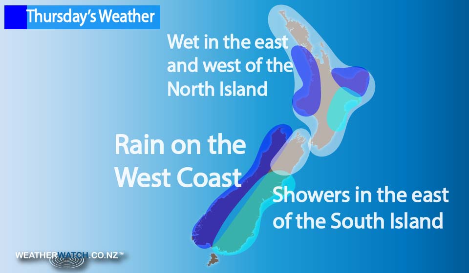
Gusty westerly winds move in during the afternoon around the North Island, and most regions should see some rain or showers – especially in the west, where rain may be heavy – then easing to showers.
Heavy rain is set for the Bay of Plenty and East Cape in particular, while the East Coast overall has plenty of high cloud, and some rain and showers at times (more persistent about Gisborne) which eases in the afternoon and clears during the evening.
Rain is also in store for the West Coast of the South Island (with heavy falls possible in the morning), before this eases during the afternoon, as northerlies change southwest.
For the South Island in general, it’s mostly cloudy in the east, with showers around Southland and Otago from morning, then pushing into Canterbury during the morning and into afternoon, as southwesterlies freshen.
Marlborough is fairly dry, while high cloud may even break to a few sunny areas in the afternoon, along with northwest winds.
– Aaron Wilkinson & Drew Chappell, WeatherWatch.co.nz
Comments
Before you add a new comment, take note this story was published on 22 Jun 2016.
Latest Video

NZ VIDEO: Severe weather going into the weekend. Next week: Westerlies continue
Heavy rain and northerly gales are moving across NZ going into the weekend as a large low from the Tasman…
Related Articles
NZ VIDEO: Severe weather going into the weekend. Next week: Westerlies continue
Heavy rain and northerly gales are moving across NZ going into the weekend as a large low from the Tasman…

VIDEO: Low pressure, cold fronts, main feature next two weeks
There are several low pressure zones and cold fronts coming into NZ, with westerly driven weather dominating our weather pattern…

VIDEO: Burst of wind and rain for NZ as low pressure dominates
Air pressure around New Zealand will continue to drop in the days ahead as low pressure systems affect our weather…


Add new comment