Archives for March 2020

“High” risk for Cyclone to form in Coral Sea on Friday. May reach northern NZ next week.
WeatherWatch.co.nz forecasters are closely monitoring a tropical depression which will become a tropical cyclone, likely on Friday. Yesterday WeatherWatch.co.nz said…
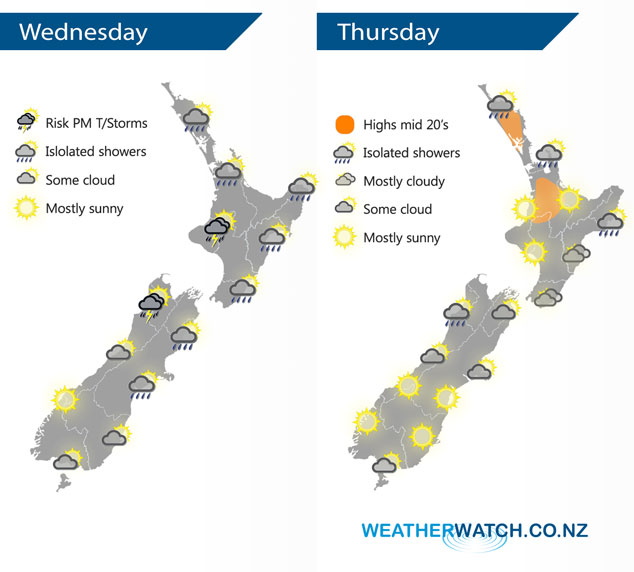
InfoGraphic: The Big Picture for Wednesday / Thursday
A southwesterly airflow lies over New Zealand today, potentially becoming unstable for Buller and some parts of the upper North…

Wednesday’s national forecast
A southwesterly airflow lies over New Zealand today, potentially becoming unstable for Buller and some parts of the upper North…

InfoGraphic: The Big Picture for Wednesday
A southwesterly airflow lies over New Zealand on Wednesday, potentially becoming unstable for Buller and some parts of the upper…

VIDEO: Tropical Cyclone to form in Coral Sea, may track towards NZ area
Showers will be spreading around NZ for the next day or two but all eyes are to our north with…
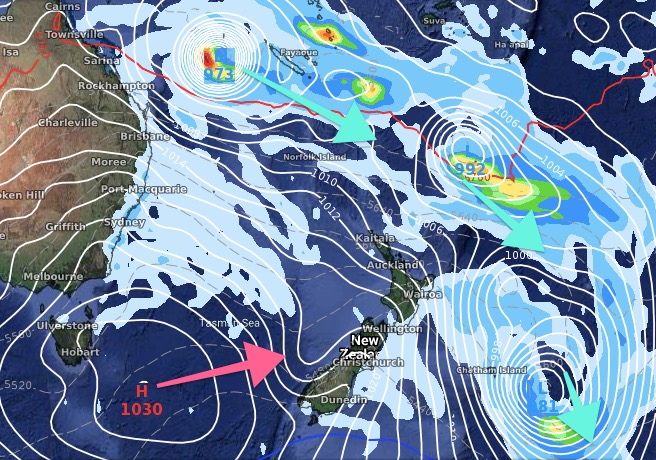
High chance of a Coral Sea cyclone forming, may drift towards NZ (+2 Maps)
A tropical cyclone is forming in the Coral Sea this week and modelling is agreeing it’s very likely to form…

DroughtWatch: How much fell yesterday + 7 day outlook (+5 maps)
Showers and patchy rain moved across the upper North Island yesterday and more is on the way. Totals varied but…
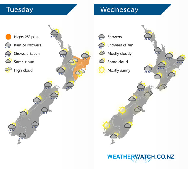
InfoGraphic: The Big Picture for Tuesday / Wednesday
Western parts of the North Island get the odd shower in a westerly airflow today, drier out east. Cool southerlies…
Tuesday’s national forecast
Western parts of the North Island get the odd shower in a westerly airflow today, drier out east. Cool southerlies…

InfoGraphic: The Big Picture for Tuesday
Western parts of the North Island get the odd shower in a westerly airflow on Tuesday, drier out east. Cool…

