
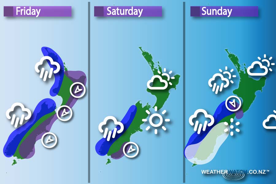
Friday
Blue: Rain for the western coasts of both islands
Purple: Strong winds in the east of the North Island, Cook Strait and South Island – as well as Canterbury
The front pushes northwards over the country during the day, meaning gusty northeast winds in the east, and heavy spells of rain in the west of the country.
Saturday
Purple: Strong gusts of wind around coastal Southland
Blue: Heavy falls on the West Coast towards evening
A slight ridge of high pressure sits over New Zealand, while westerly winds around Southland and Otago may be gusty at times from afternoon onwards.
Sunday
Purple: Strong winds in Cook Strait
White: Snow in Southland, Otago & Canterbury
Blue: Rain continues on the West Coast
A front moves over the South Island during the morning & into afternoon, reaching the North Island in the evening.
Northwesterlies ahead of the front then change southwest in behind – bringing low temperatures with it.
– Please note, the idea behind this update is to focus on the main weather highlights, which is why not all regions are mentioned.
For specific 10 day information for your city, town, rural community or island please see the 1000 forecasts on our homepage!
– Aaron Wilkinson & Drew Chappell, WeatherWatch.co.nz


Add new comment