The day before the low – The Big Picture on Wednesday
5/07/2016 7:57am

> From the WeatherWatch archives
While a large, rain-bearing low pressure system starts to ominously gather across the Tasman, New Zealand sits under a ridge of high pressure as Wednesday begins.
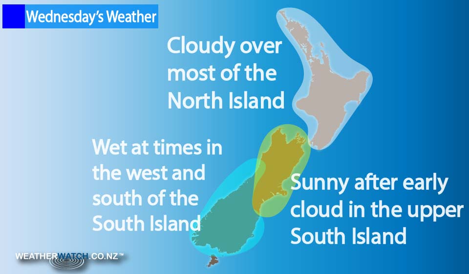
There’s a mix of sun and cloud around for much of the North Island, while there may be areas of fog in the morning and again overnight – especially about inland areas.
High cloud thickens from afternoon over the North Island, moving in from the west.
For the upper South Island, any morning cloud breaks to a mostly sunny day, while some high cloud gathers from afternoon or evening, and winds are mainly light.
Southland sees afternoon showers with a southwest change, though, and a few showers may make it into Otago in the evening.
Rain moves into Fiordland in the morning, while there’s a chance of a shower further north along the West Coast late afternoon and into the evening.
– Aaron Wilkinson & Drew Chappell, WeatherWatch.co.nz
Comments
Before you add a new comment, take note this story was published on 5 Jul 2016.
Latest Video

NZ VIDEO: More lows, but a reduction in severe weather
More low pressure is coming in to New Zealand this week – but rainfall isn’t as dramatic as previous weeks,…
Related Articles
NZ VIDEO: More lows, but a reduction in severe weather
More low pressure is coming in to New Zealand this week – but rainfall isn’t as dramatic as previous weeks,…

NZ VIDEO: Westerlies, lows, showers & large dry areas
Messy westerly driven weather will affect NZ this week, bringing more wet weather to western and northern parts of the…

NZ VIDEO: Westerlies continue
Heavy rain and northerly gales are moving across NZ going into the weekend as a large low from the Tasman…


Add new comment