Small pocket of intense downpours approaching western North Island before dawn Sunday
8/07/2017 11:35am

> From the WeatherWatch archives
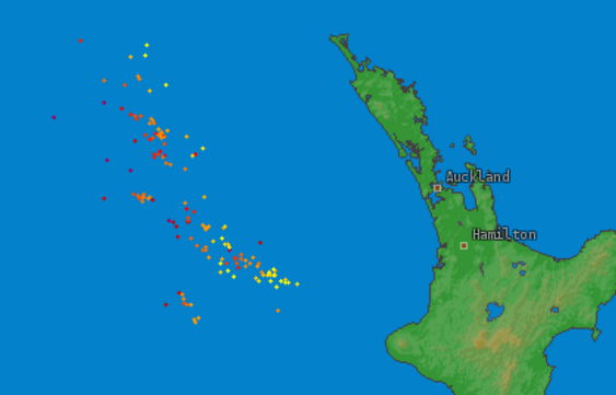
Updated 11:35pm — A small but quite intense area of heavy downpours & isolated thunderstorms is approaching the western North Island early Sunday morning, mainly between New Plymouth and Hamilton but may affect western areas from Taranaki to Auckland. Northland has some risk too, although much lower.
At this stage the Forecast Rain Radar suggests the Waitomo region may be most exposed, but the rain area we’re monitoring is still well offshore and unstable, so current flare ups that we can see now may ease before landfall while new areas flare up. It’s not a repeat of what happened in Auckland the other day.
Highest risk for thunderstorms and/or intense downpours looks to be mainly around 3am +/1 an hour or two. It should weaken then as it tracks eastwards over land.
3am Sunday Future Rain Radar (click to see how it will track, where is most exposed)
8:30pm Saturday Lightning Tracker (click for live version)
– WeatherWatch.co.nz
Comments
Before you add a new comment, take note this story was published on 8 Jul 2017.


Add new comment