More heavy rain, strong winds in store – The Big Picture on Thursday
26/07/2016 10:43pm

> From the WeatherWatch archives
Thursday does not see an improvement in recent rough conditions – and it’s not the last of this weather either, as the week will end in a similar fashion.
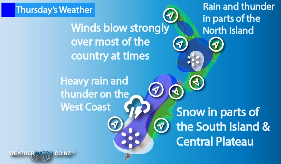
Rain moves onto the western side of the North Island in the morning, becoming heavy for most by midday.
While the rain eases at some point in the afternoon, from midday there is a risk of thunderstorms too – so even though rain eases to showers, showers may be heavy and squally with thunderstorms, before easing late in the afternoon and into evening.
On the East Coast, from Gisborne to Wairarapa, thick high cloud dominates, while a few spots of rain are possible too, mainly in the afternoon.
Snow flurries overnight fall on the Central Plateau, down to 700m in places.
The West Coast of the South Island sees early rain ease to showers, before rain sets in again from evening, with heavy falls and thunderstorms possible.
The east coast of the South Island sees any early spots of rain clear too, leading to mostly sunny conditions, along with northerly winds from the afternoon onwards.
Some high cloud develops again in the evening, while showers move into Southland and Otago for a time in the evening, becoming a bit more widespread overnight.
Winds strengthen from the southwest too, rising to gale at times.
Snow flurries fall overnight – down to 300m in the far south, while Dunedin northwards along the coast may remain fairly dry.
– Aaron Wilkinson & Drew Chappell, WeatherWatch.co.nz
Latest Video

Matariki, the long weekend + the outlook for next week
Wet weather and cloud continues along the eastern side of the country with the heaviest rain now moving into northern…
Related Articles
Matariki, the long weekend + the outlook for next week
Wet weather and cloud continues along the eastern side of the country with the heaviest rain now moving into northern…

More eastern rain, but a drier long weekend coming
Rain continues today along the eastern South Island and lower North Island, coming in from the east with heavy falls….

More heavy rain, snow – but large dry areas, especially as we go into the long weekend
Heavy rain will continue for parts of Canterbury and Marlborough over the next day or two and it will gradually…

