Dry and mild for most – The Big Picture on Wednesday
8/09/2015 5:00am

> From the WeatherWatch archives
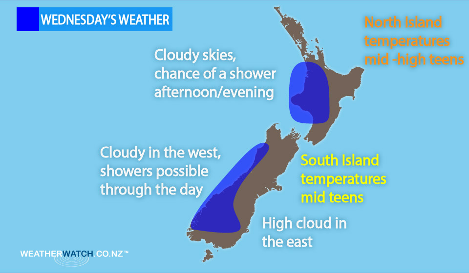
On Wednesday we have a north to northwesterly airflow lying over New Zealand, while a front moves onto the West of the South Island from afternoon, then slowly pushes northwards.
In the west of the country it’s a mainly cloudy day, while those in the east of the North Island can expect sun and some high cloud.
High cloud is also likely for the South Island in the east, which gradually increases during the day.
There is the risk of a light shower at times in western regions of the North Island, but overall it’s expected to be mainly dry – a higher chance of rain moves into Taranaki overnight.
For the South Island the only rain really about is for the West Coast, and a few spill over showers reaching into inland Central Otago in the west.
– Aaron Wilkinson & Drew Chappell, WeatherWatch.co.nz
Comments
Before you add a new comment, take note this story was published on 8 Sep 2015.
Latest Video

NZ VIDEO: More lows, but a reduction in severe weather
More low pressure is coming in to New Zealand this week – but rainfall isn’t as dramatic as previous weeks,…
Related Articles
NZ VIDEO: More lows, but a reduction in severe weather
More low pressure is coming in to New Zealand this week – but rainfall isn’t as dramatic as previous weeks,…

NZ VIDEO: Westerlies, lows, showers & large dry areas
Messy westerly driven weather will affect NZ this week, bringing more wet weather to western and northern parts of the…

NZ VIDEO: Westerlies continue
Heavy rain and northerly gales are moving across NZ going into the weekend as a large low from the Tasman…


Add new comment