
> From the WeatherWatch archives
More wind, more rain and more thunder and lightning on the way for Tuesday – as a front moves over both islands during the day.
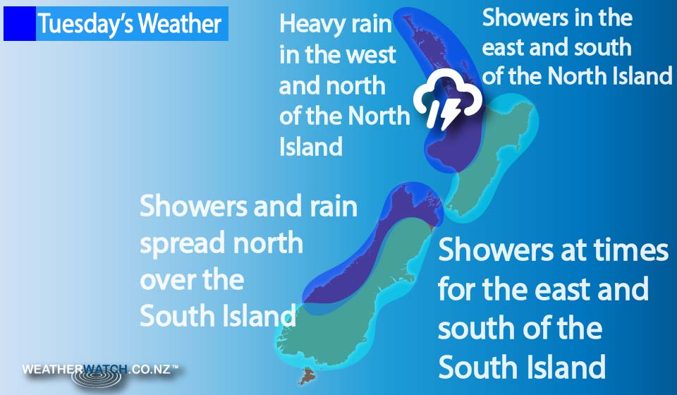
The front moves across the South Island in the morning, before pushing over the North Island in the evening.
Winds are generally gusty from the northwest ahead of the front, then changing southwest in behind.
It’s mostly cloudy for the west of the North Island with the odd shower, and evening rain – possibly heavy – with a thunderstorm or two, then easing later, as northwesterlies change southwest.
The East coast sees sunny areas and increasing high cloud, while a gusty late evening southwest change brings the chance of a few showers too.
Wellington, meanwhile, sees cloud turn to rain late in the day, along with changeable winds.
It’s cloudy for the West Coast of the South Island too, with the odd shower, and then rain moving into South Westland in the morning.
The rain then spreads further north in the afternoon, becoming heavy at times with the chance of thunder, then easing by evening as southwesterlies push through.
The east coast sees thick high cloud and northerlies, along with a few evening showers and a southwest change.
Southland and Otago see morning rain ease to showers, while Nelson in the north see some showers turn heavier in the afternoon.
– Aaron Wilkinson & Drew Chappell, WeatherWatch.co.nz
Latest Video

Matariki, the long weekend + the outlook for next week
Wet weather and cloud continues along the eastern side of the country with the heaviest rain now moving into northern…
Related Articles
Matariki, the long weekend + the outlook for next week
Wet weather and cloud continues along the eastern side of the country with the heaviest rain now moving into northern…

More eastern rain, but a drier long weekend coming
Rain continues today along the eastern South Island and lower North Island, coming in from the east with heavy falls….

More heavy rain, snow – but large dry areas, especially as we go into the long weekend
Heavy rain will continue for parts of Canterbury and Marlborough over the next day or two and it will gradually…

