
> From the WeatherWatch archives
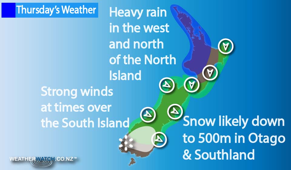
The rough, cold and wet weather is continuing – with a front moving off the North Island in the morning, and while that wet weather continues, rain does ease for many in the afternoon, while winds remain fairly gusty from the west or southwest too.
Strong northerlies blow initially on the East Coast of the North Island, before the change moves through.
The West Coast of the South Island sees morning rain and any thunderstorms ease to showers also, while afternoon sunny spells are even possible.
The rain picks up again from evening and overnight though, with further heavy rain and thunderstorms.
The east coast of the South Island, apart from some morning high cloud and a spot of rain first thing, breaks to a mostly sunny afternoon, along with breezy west to northwest winds.
Overnight northwesterly winds strengthen for much of the South Island – especially the upper half – in the east, with gales likely.
A southwest change moves onto Southland and Otago overnight, bringing some rain for a time and snow down to 500m – then easing around dawn on Friday.
– Aaron Wilkinson & Drew Chappell, WeatherWatch.co.nz
Comments
Before you add a new comment, take note this story was published on 13 Jul 2016.
Latest Video

NZ VIDEO: More lows, but a reduction in severe weather
More low pressure is coming in to New Zealand this week – but rainfall isn’t as dramatic as previous weeks,…
Related Articles
NZ VIDEO: More lows, but a reduction in severe weather
More low pressure is coming in to New Zealand this week – but rainfall isn’t as dramatic as previous weeks,…

NZ VIDEO: Westerlies, lows, showers & large dry areas
Messy westerly driven weather will affect NZ this week, bringing more wet weather to western and northern parts of the…

NZ VIDEO: Westerlies continue
Heavy rain and northerly gales are moving across NZ going into the weekend as a large low from the Tasman…


Add new comment