News
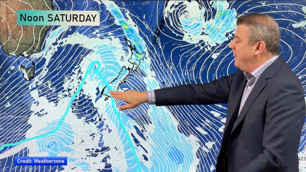
Colder change moving in this weekend, frosts for some next week
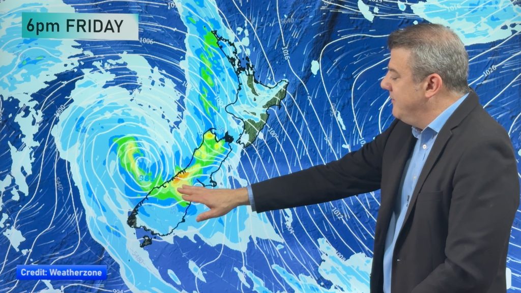
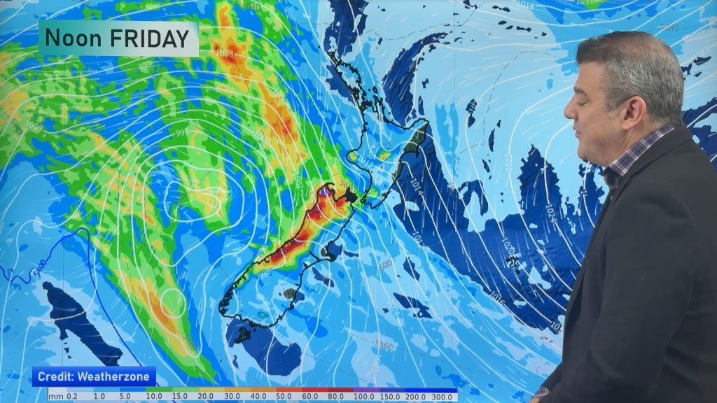
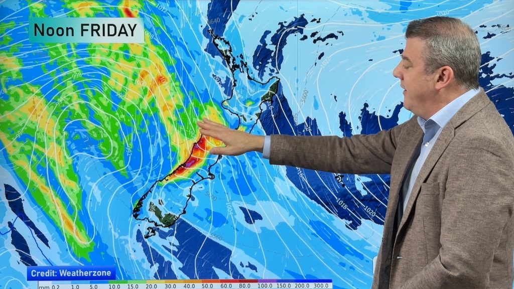
Low pressure will cross over the South Island on Friday night bringing more heavy rain to western and northern parts…
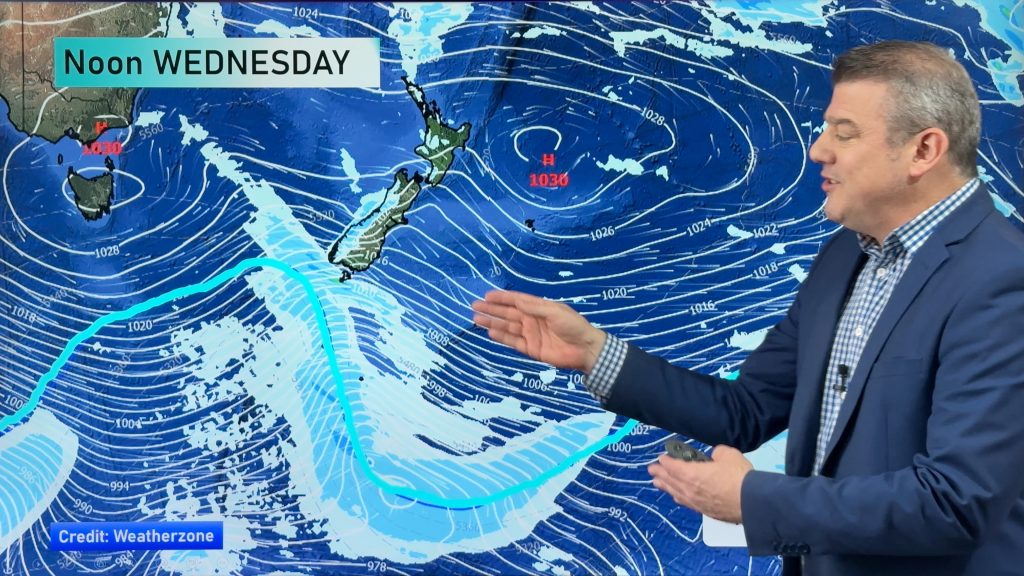
Rain and showers, then colder and drier next week
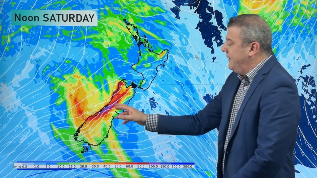
Low pressure is moving into NZ and will bring heavy rain to the western side of the South Island and…
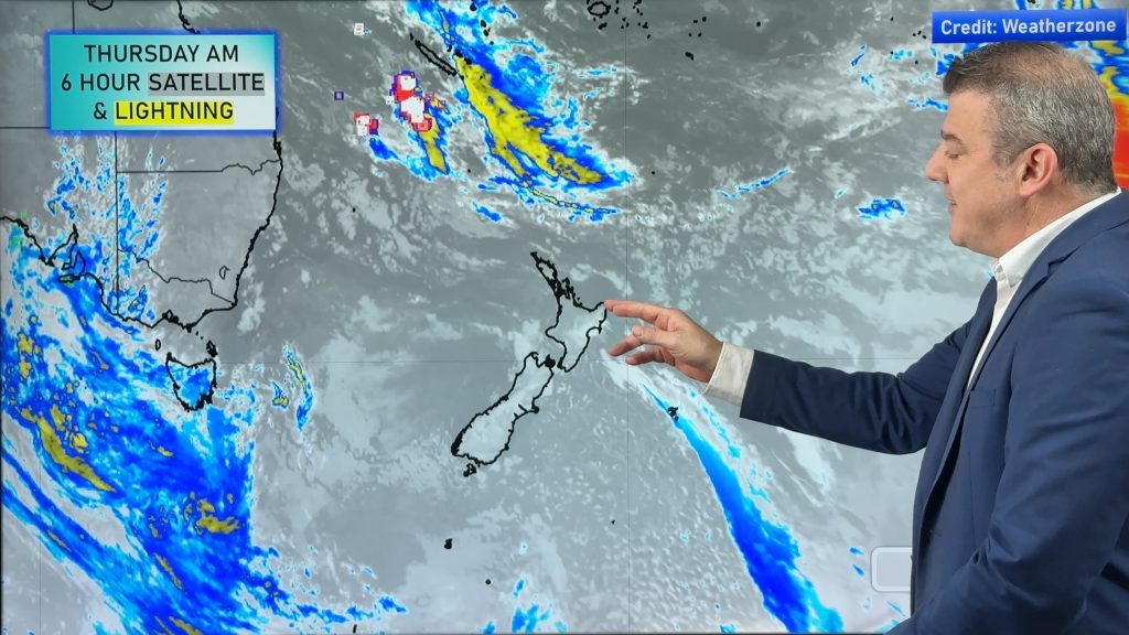
Rain and wind, then a temperature drop
Milder winds will affect the nation over the next day or two as a messy low pressure zone moves in…
Wind, rain and a colder change coming before next big high
High pressure is now moving off NZ to our east, replaced by cloudier weather and northerly quarter winds, with heavy…
NZ: High pressure slips away, wintry snap for some late week/Saturday
High pressure is still over New Zealand but it will slip away to the east this week allowing for West…

ClimateWatch: May outlook & El Niño discussion
Everyone is talking about El Niño so in this month’s update we discuss when it may be forming and what…
High pressure for much of the country: 10 day outlook
Powerful high pressure is moving over New Zealand not only for this weekend but possibly for the next couple of…
A cold front to brush the south, but high pressure dominates
Today’s video is short and sharp because there isn’t a lot of weather on the way! A cold front will…
NZ weather forecast to May 1st
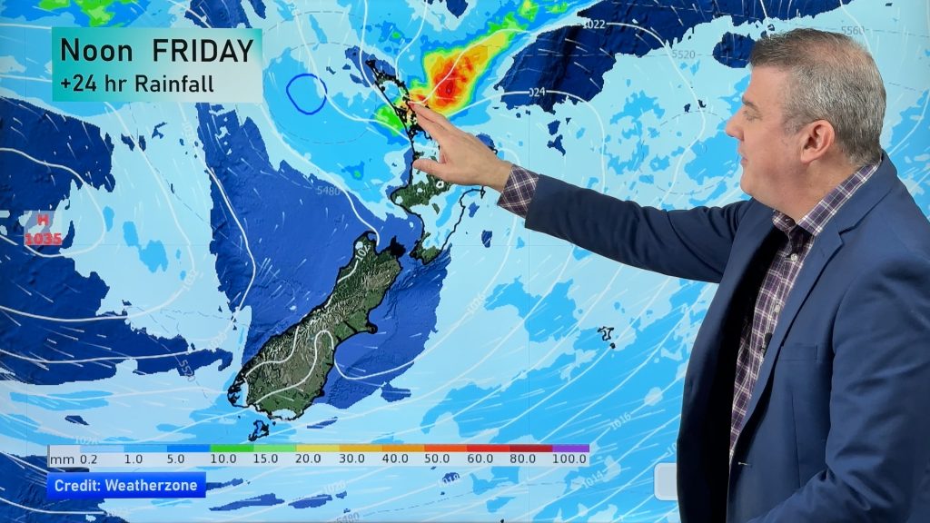
Heavy rain moves north of Auckland city today but remains in the north of the region and should be clearing…
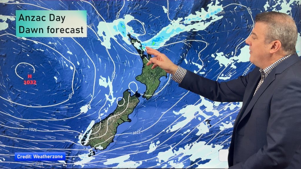
NZ: Anzac Day + long weekend weather, and how next week is shaping up
High pressure is trying to move in to NZ, but there is still the chance of some heavy rain in…

