Typhoon Mangkhut now aiming for southern China, Hong Kong (+Maps)
15/09/2018 9:16pm

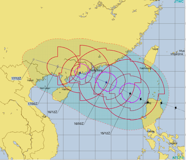
Typhoon Mangkhut is located over the South China Sea, passing through the upper Philippine Island of Luzon yesterday.
Max winds speed is 195km/h with gusts to 240km/h by JMA. By Monday morning NZT maximum 1-min wind speeds are estimated to be 175km/h with gusts to 215km/h according to the JTWC. It is gradually forecast to weaken.
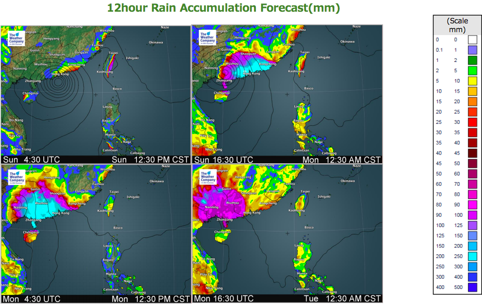
24hr rainfall accumulation is forecast to exceed above 100 mm in the eastern coastal parts of Taiwan and about 140-260mm in the vicinity of Rongcheng and Hong Kong . (The possibility of Flooding is high. Attention required.)
Violent winds of above 150km/h are forecast in the vicinity of Hong Kong.
Mangkhut will move west-northwestward through Sunday and will bring heavy rain, damaging gusty winds and storm surge around southern China and Hong Kong. Sustained winds of 90 to 110km/h, gusting 130 to 170km/h on the 16th (local time) are forecast in Hong Kong Island.

– WeatherWatch.co.nz with additional from The Weather Company/IBM
Comments
Latest Video

VIDEO: NZ’s Autumn showers + sub-tropical developments
NZ has a classic Autumn sou-wester today and this eases into Friday and the weekend. Next week low pressure forms…
Related Articles

ClimateWatch: MAY’s outlook as El Niño ends, NEUTRAL pattern arrives (+Video & 13 Maps)
El Niño may be technically gone but the weather pattern it created is still with our part of the world. By…

Meteors – Your Eyewitness Reports!
WeatherWatch.co.nz receives meteor reports from all over New Zealand and the globe, 24/7/365. **CASUAL COMMENTS**If you’ve seen something in the…

Weekend Newsfeed: High pressure arrives, dragging in some cloud, more settled nationwide
Sunday – High pressure crosses NZ properly and winds ease for many regions and most (but not all) showers will…


Add new comment