Weekend Newsfeed: Rain moves northwards, Stormy for some on Monday/Tuesday
2/03/2024 7:44pm

> From the WeatherWatch archives
Sunday: A rain band moves into the western side of the North Island with some patchy rain and showers – hit and miss for those who need rain, and driest in the east. Westerlies winds continue for many. Rain returns to the South Island’s southern and western sides later on and into Monday.
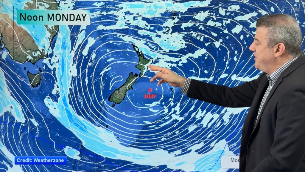
Monday: Strong to gale force westerlies kick in, severe gale possible in places like Wellington, Wairarapa central NZ, the Southern Alps, inland eastern areas of the North Island. Rain is heavy on the West Coast and moves into the North Island with hit and miss downpours. Thunderstorms possible. Snow on the Southern Alps. Colder air arrives in southern NZ. Gusty weather may ease for a time on Monday before gale westerlies kick in overnight and into Tuesday morning in some exposed places. Worst winds will be from Taranaki to Hawke’s Bay southwards, but Auckland may have coastal gales for a time too.
Additional Weather Maps most helpful this weekend are…

WeatherWatch.co.nz / New App / RuralWeather.co.nz
Comments
Before you add a new comment, take note this story was published on 2 Mar 2024.
Latest Video
NZ 8 day outlook as high pressure moves through
High pressure will cross the South Island this weekend bringing light winds, cold nights, frosts and fog, while the North…
Related Articles
NZ 8 day outlook as high pressure moves through
High pressure will cross the South Island this weekend bringing light winds, cold nights, frosts and fog, while the North…
Eastern cloud/showers for the NI, high pressure expands elsewhere
A colder south to south-east flow will keep clouds and showers moving into some eastern parts of the North Island…
High pressure growing slowly, eastern showers for NI
A colder airflow is spreading across all of NZ now and will continue on as high pressure slowly moves towards…


Add new comment