
> From the WeatherWatch archives
Last Saturday evening, local time, a massive mayfly emergence along the upper part of the Mississippi River was caught on weather radars.
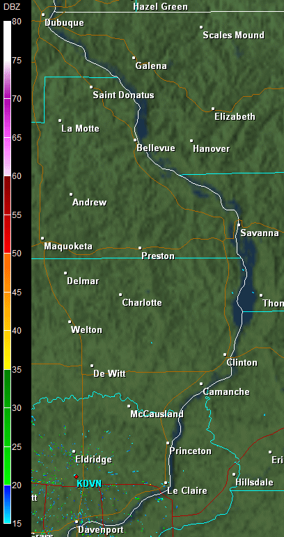
These images are from the weather radars at National Weather Service offices in La Crosse, Wisconsin and Davenport, Iowa.
This is not the first time weather radar has caught this phenomenon. But this particular event produced some very striking images. Not only do these images indicated the magnitude of the emergence, but you can also see evidence of the south wind that was in place that night as it helped to push the mayflies along.

La Crosse, Wisconsin
.gif)
Davenport, Iowa
Homepage image/ NOAA
Radar images courtesy of NOAA
By WeatherWatch Analyst Howard Joseph
Latest Video

Some polar airflows but more high pressure to affect NZ’s weather
Showers are in the forecast over the next several days, we track where and when they occur – but there…
Related Articles

ClimateWatch: JULY outlook & what El Niño means for NZ
El Niño is officially here and still getting stronger in the months ahead, but it’s harder to notice its effects…

ClimateWatch: JUNE outlook as El Niño continues to build
June has kicked off in NEUTRAL again as far as El Niño is concerned, but it is expected to form…

ClimateWatch: May outlook & El Niño discussion
Everyone is talking about El Niño so in this month’s update we discuss when it may be forming and what…

