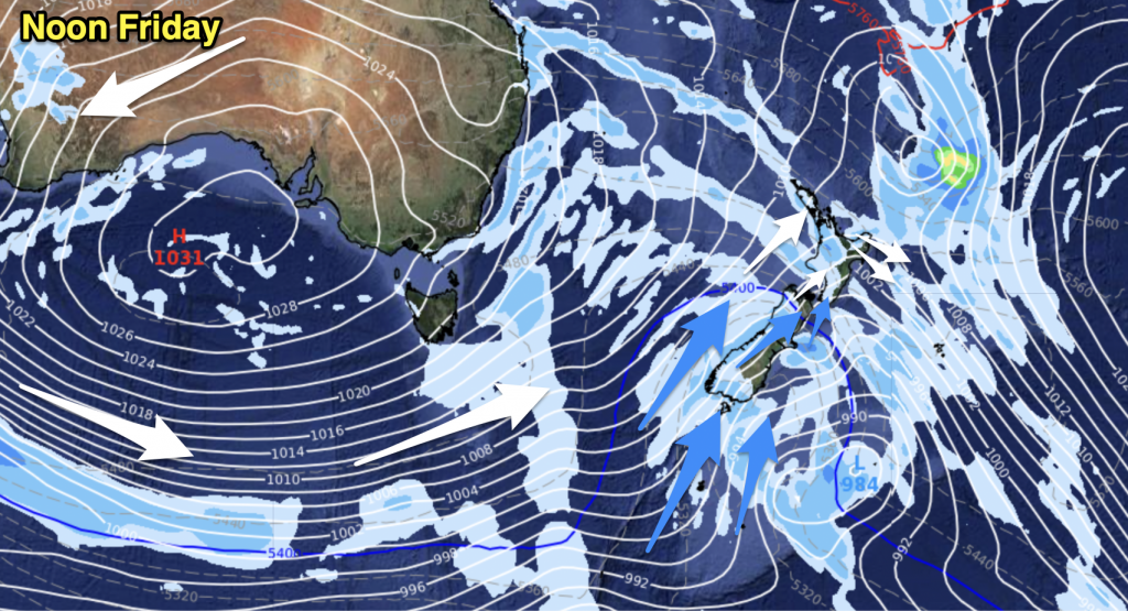
A deepening developing low has been approaching New Zealand overnight bringing isolated thunderstorms to the western North Island, torrential downpours to the west and snow to the South Island ranges.
Along the front between the more mild air over the North Island and cold air in the South Island a lot of thunderstorms have been observed – with many more coming in this morning from the Tasman Sea.
The low will keep on impacting the country until Wednesday with the main cold change sweeping north today and tonight over the entire nation.
Strong winds will cover the country, up to gale at times in a few exposed areas.
RAIN/SNOW ACCUMULATION NEXT 48 HOURS:

– WeatherWatch.co.nz


Add new comment