Thursday’s national forecast – The storm slowly moves away (+7 Maps)
20/01/2021 3:00pm

The storm that has impacted New Zealand this week will today finally slowly move away to the south east.
A few remaining snow flurries continue on the tops of the Southern Alps while more wet weather affects Southland, Otago and others parts of the South Island.
The North Island has showers in the west but is dry or mainly dry to the north and east.
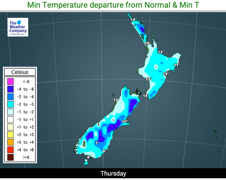
Temperatures today will again be below normal in most of New Zealand by a few to several degrees. A slight warm up kicks back in on Friday in the south.
Winds will still be blustery in some exposed areas but the risk for gales continues to diminish today. Friday looks even calmer as high pressure moves over the north Tasman Sea.
As always, refer to your LOCAL and HOURLY forecasts to break this all down much more.


Comments
Latest Video

Tuesday Newsfeed: High exits, low enters. We track the new wet weather.
High pressure that has dominated NZ’s weather pattern for over two weeks is now finally moving out to the east…
Related Articles

Wednesday Newsfeed: Low pressure crosses NZ
A low from the Tasman Sea will cross the country on Wednesday bringing patchy rain and showers to the North…
Tuesday Newsfeed: High exits, low enters. We track the new wet weather.
High pressure that has dominated NZ’s weather pattern for over two weeks is now finally moving out to the east…

VIDEO: More than 1 low coming to NZ next 6 days
If you need rain then there is some (patchy) good news. A low will cross NZ on Wednesday with a…


Add new comment