
> From the WeatherWatch archives
A deep low is expected to cross the North Island this weekend bringing more wind and rain – and as the low moves out to the east coast it will dredge up a cold southerly for most of the nation.
Spring is the season where winter slowly fades out and we slowly get hints of summer – so expect to get more mixed up weather patterns with sub-tropical, mild, wind flows one day and a colder southerly the next.
But unlike the middle of winter the cold events tend to be shorter lived – in saying that, with so many newborn livestock across the country we want to update you as best we can, as early as possible.
With that in mind – here’s our latest honest and no-hype forecast…prepared by our weather analyst Aaron Wilkinson…
The Cold Forecast this Saturday and Sunday…
It looks cold but not sea level cold. Only slight chance to sea level is about Otago on Sunday, but that’s it.
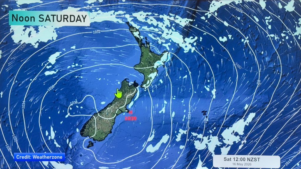
However the air certainly looks cold on Saturday due to a southwesterly airflow over the South Island – but precipitation doesn’t appear to be very heavy and is quite scattered – ie, if it snows it won’t be set in for a day and will be patchy across the region affected.
In the South Island, generally Saturday afternoon/evening showers may contain small hail and perhaps some snow flurries to 400 / 300m. Maybe down to 200m about Southland / Otago. At this stage the early data suggests snow flurries will be isolated.
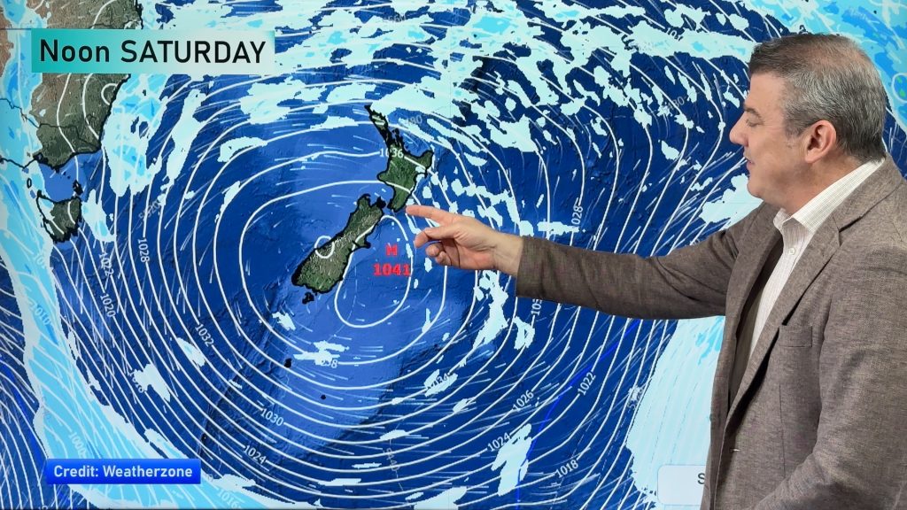
Sunday sees a cold southerly quarter airflow over most of the country, due to the nature of the flow it looks like Southland and Otago are most exposed, and perhaps only coastal Canterbury sees some shower activity (Banks Peninsula). Snow flurries to low levels about Southland / Otago and about 300 / 200m on Banks Peninsula. But nothing overly untoward on Banks Peninsula. Southland / Otago may get a bit more though but perhaps no more then 5 to 10cm down to the levels mentioned above.

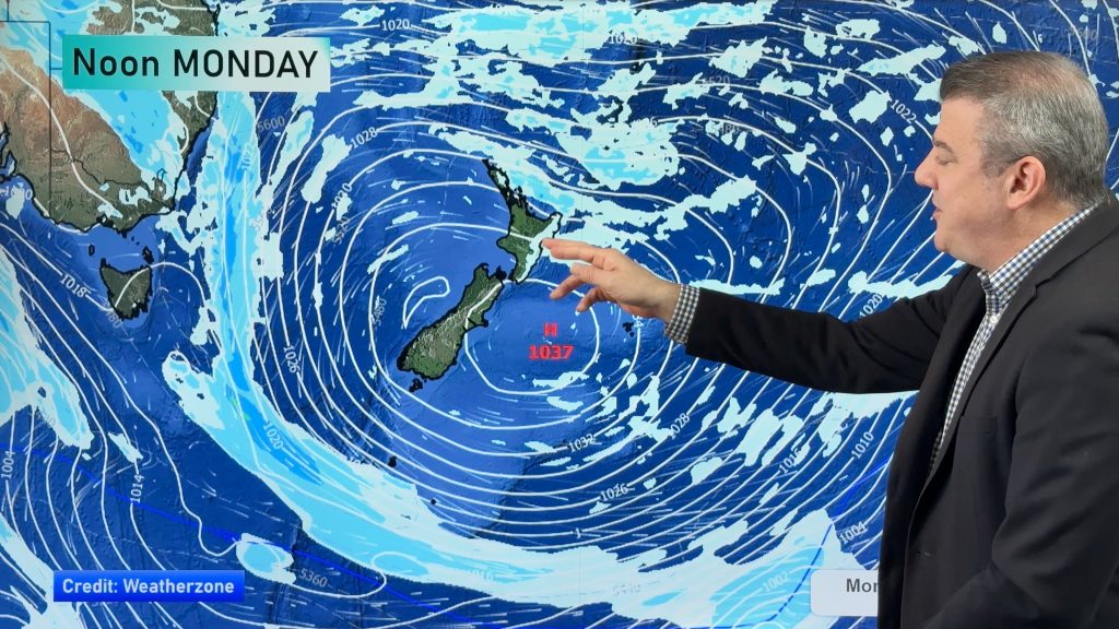
Sunday AM shows the strong south to south west flow over NZ – pink/blue/yellow shading are showers. The far west of the map shows a large high coming in from the Tasman (the high to the left and the low to the right will work together to dredge up the southerly change…that same high will fade out the southerly very early next week).
Uncertainty?
Keep in mind – we are being very detailed a long way out and things may change – but we’re trying to give you a feel for this event so you can look into it further and plan accordingly. Wind chills may be tough on newborn stock for a time, so if you can shelter stock over the weekend from the worst of the exposed winds that would be a positive, especially if you’re in Southland and Otago and around the Central Plateau.
So yes, a cold snap on the way but based on data and our latest forecasts at this stage it’s not looking too rough – perhaps more of an inconvenience.
Because the low over the North Island will be so changeable (as it will be deepening, growing and changing shape as it moves over us on Saturday and out to our east on Sunday) this will affect wind flows right across New Zealand and therefore will affect pricisely who is most exposed to the coldest air. So we’ll have a more detailed update for you around Thursday.
– WeatherWatch.co.nz
Comments
Before you add a new comment, take note this story was published on 1 Sep 2015.
Latest Video
NZ 8 day outlook as high pressure moves through
High pressure will cross the South Island this weekend bringing light winds, cold nights, frosts and fog, while the North…
Related Articles
NZ 8 day outlook as high pressure moves through
High pressure will cross the South Island this weekend bringing light winds, cold nights, frosts and fog, while the North…
Eastern cloud/showers for the NI, high pressure expands elsewhere
A colder south to south-east flow will keep clouds and showers moving into some eastern parts of the North Island…
High pressure growing slowly, eastern showers for NI
A colder airflow is spreading across all of NZ now and will continue on as high pressure slowly moves towards…


Add new comment